George Bellas Greenough
A Physical and Geological Map of England and Wales
1865
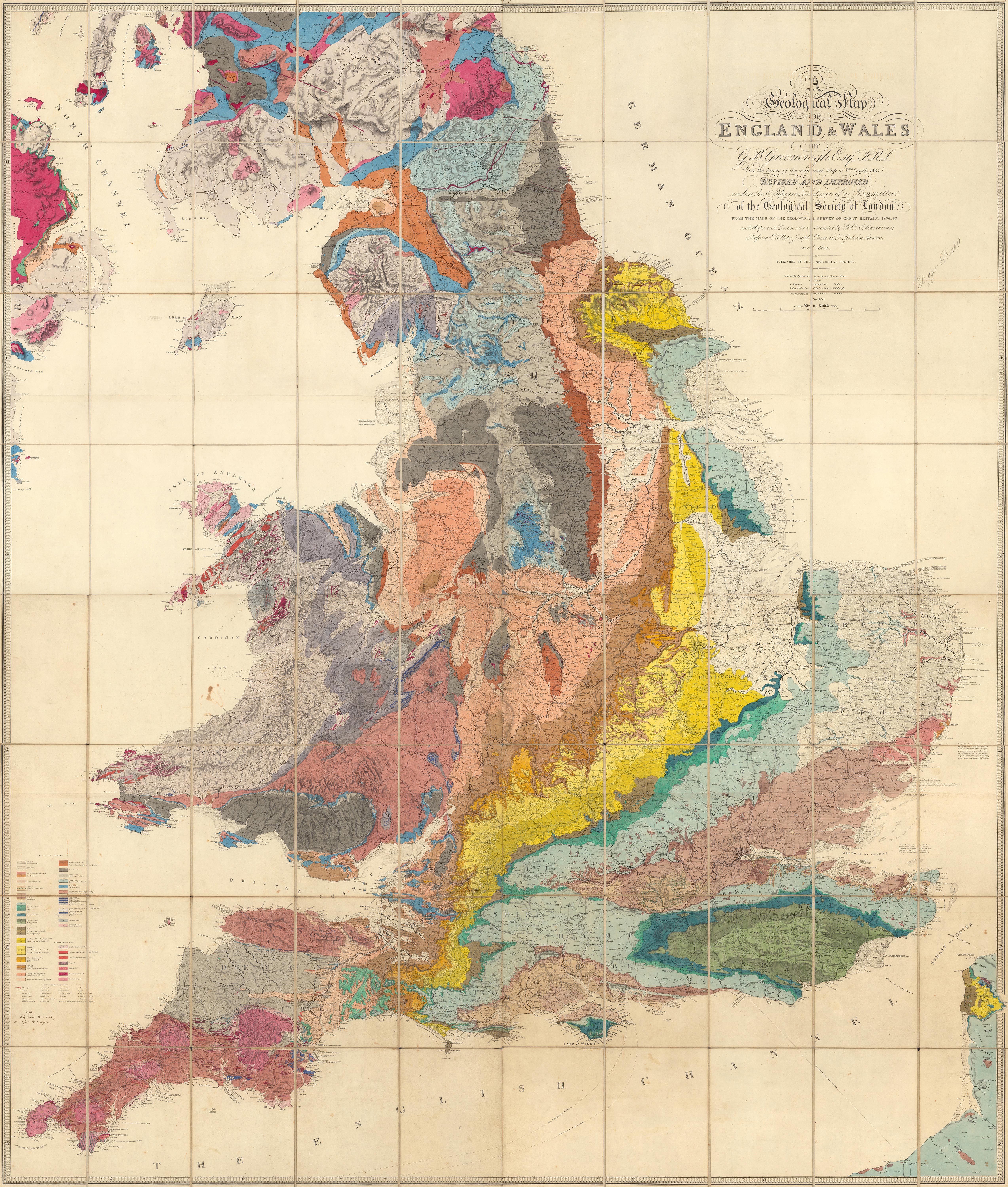
George Bellas Greenough FRS FGS (18 January 1778 – 2 April 1855) was a pioneering English geologist. He is best known as a synthesizer of geology rather than as an original researcher. Trained as a lawyer, he was a talented speaker and his annual addresses as founding president of the Geological Society of London were influential in identifying and guiding contemporary geological research. Greenough advocated an empirical approach to the early science; his scepticism of theoretical thinking courted controversy amongst some contemporaries, especially his doubts of the usefulness of fossils in correlating strata. He compiled a geological map of England and Wales, published in 1820 and in the penultimate year of his life used similar methods to produce the first geological map of British India.
—
Greenough first published this map in 1820, then a second edition in 1839, and this final third posthumous edition in 1865. Greenough drew heavily on William Smith’s Geological map of England and Wales but did not credit him until the third edition. There are several differences between the Greenough and Smith maps: Greenough delineates the topography and Smith does not, and Greenough’s scale is 6 miles to the inch vs Smith at 5 miles to the inch. There were also differences underlying the geology of both maps. Greenough made significant revisions to the second edition and to this final third edition. Following the publication of the first 1820 edition, there was a continuing dispute between Greenough and Smith as to Greenough’s uncredited use of Smith’s map.
Lieu: England and Wales
Collection: David Rumsey Historical Map
Text: Wikipedia - David Rumsey Historical Map
Publié: Novembre 2020
Catégorie: Cartographie
Source