François E. Matthes
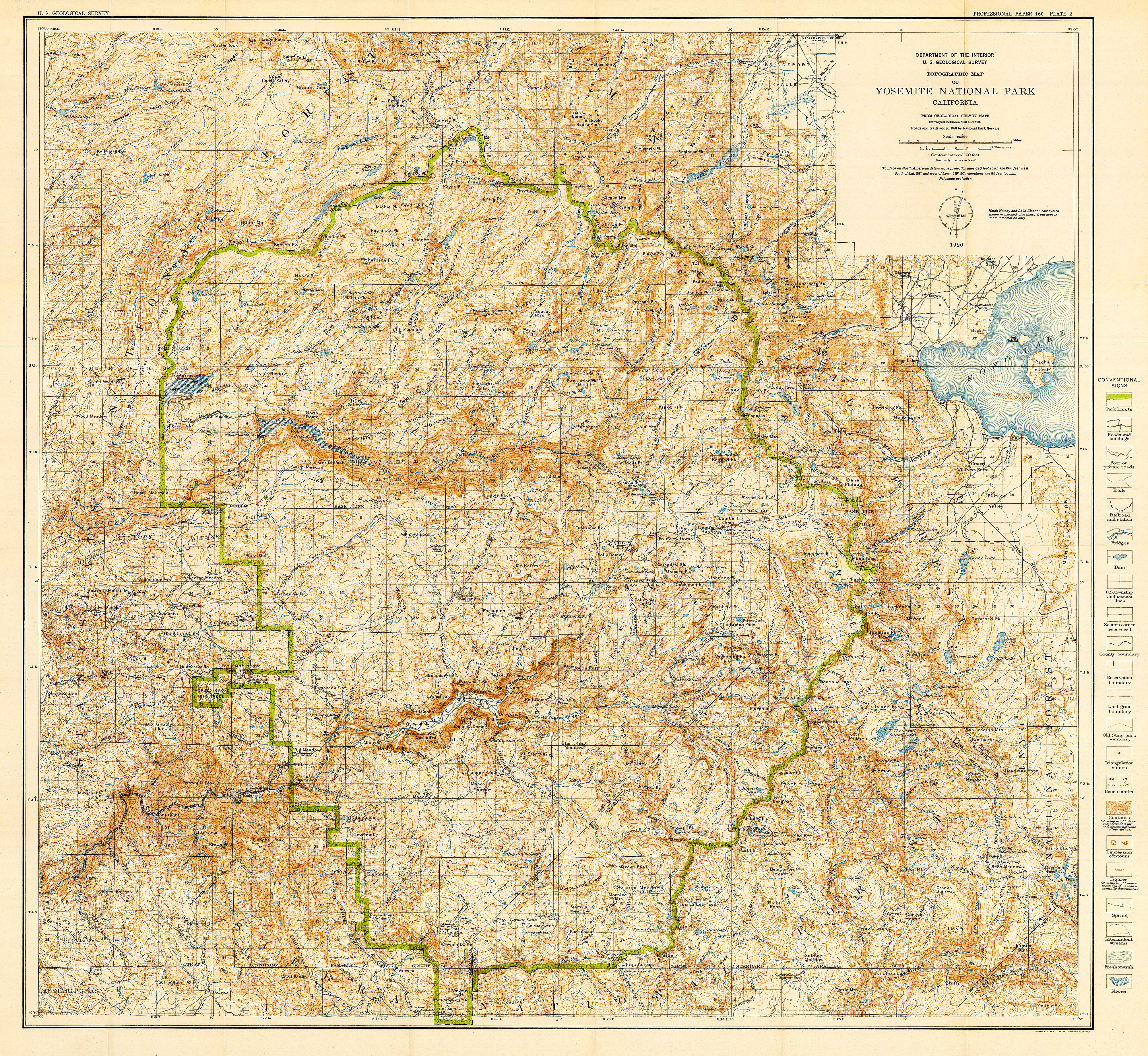
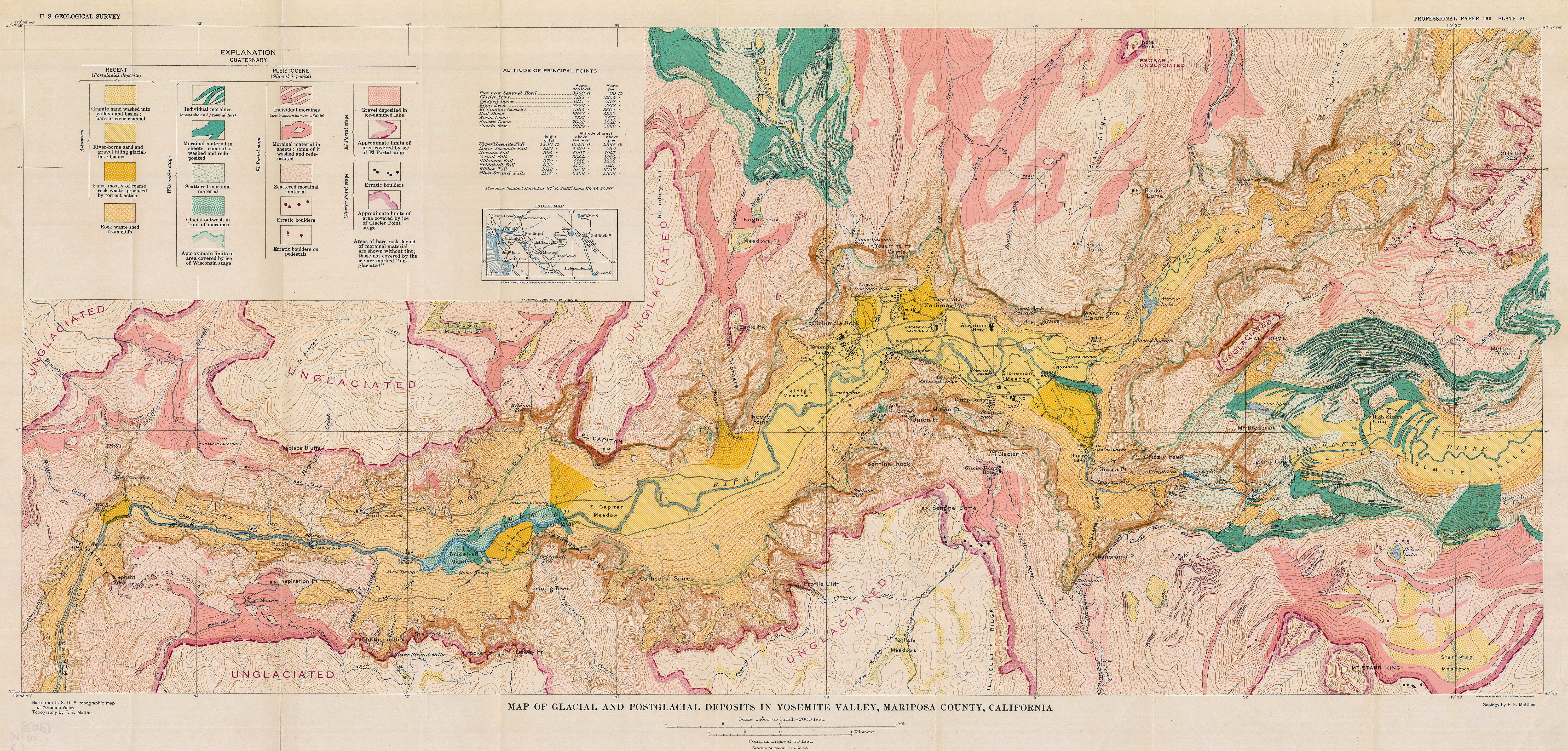
Geologic history of the Yosemite Valley
1930
The problem of the origin of the Yosemite Valley inherently demands a solution in quantitative terms. Its essence is, to what extent is the valley a product of glacial action, to what extent a product of stream erosion? The principal result of the investigations upon which this report is based is the determination within narrow limits of the preglacial depth of the Yosemite Valley and of other facts concerning its preglacial development which permit fairly definite estimates of the proportionate shares of work performed by stream and by glacier. The investigations comprise a detailed survey of the glacial and geomorphologic features of the Yosemite region and an equally intensive study of its rock formations, supplemented by reconnaissance work of both kinds in adjoining parts of the Sierra Nevada. The petrologic studies were made by Frank C. Calkins; the glacial and geomorphologic survey by François E. Matthes.


Lieu: California, USA
Text: U.S. Geological Survey
Publié: Mai 2020
Catégorie: Cartographie
Source