U.S. Navy
Ice Charts Baltic Sea
1946
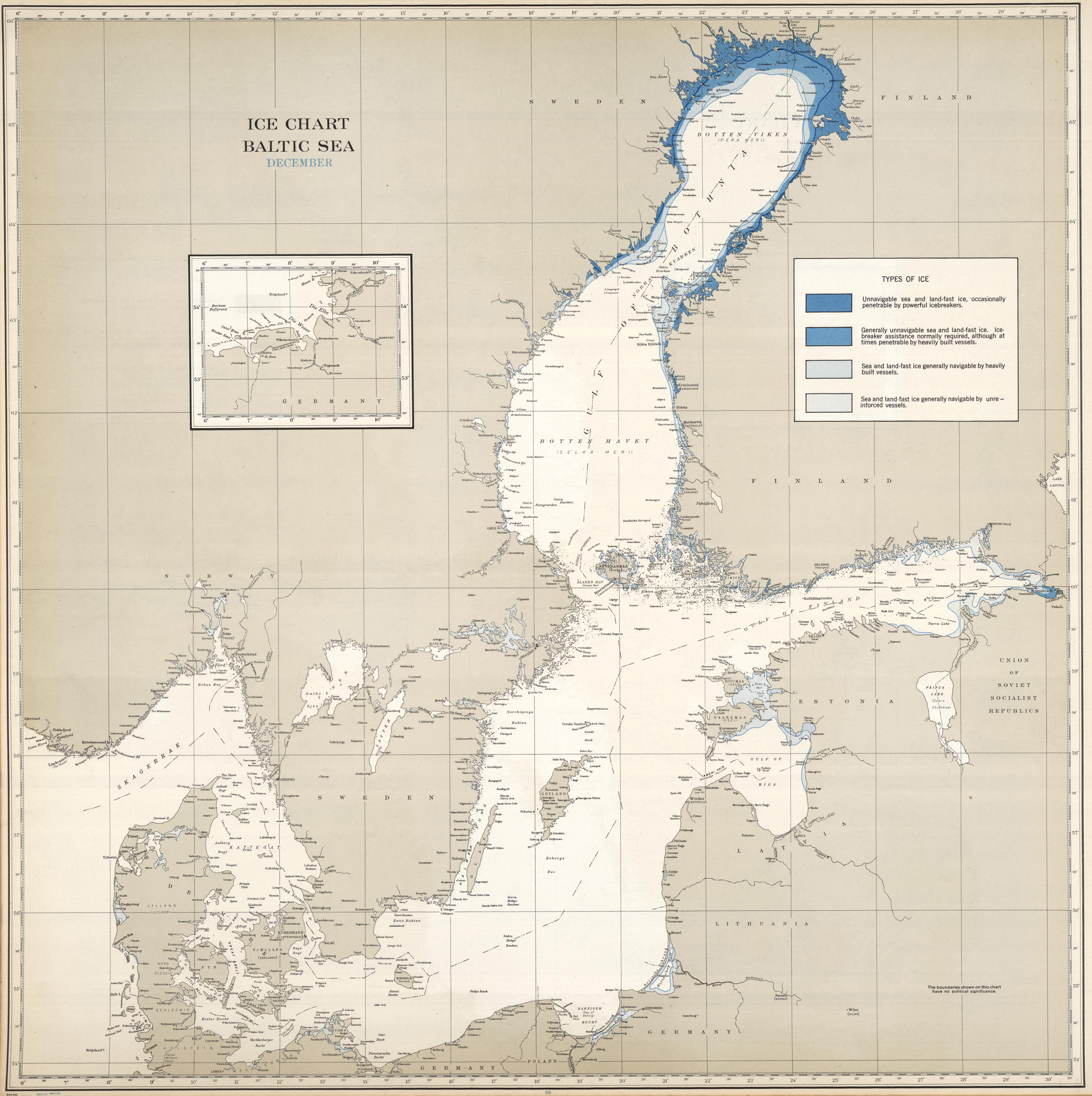
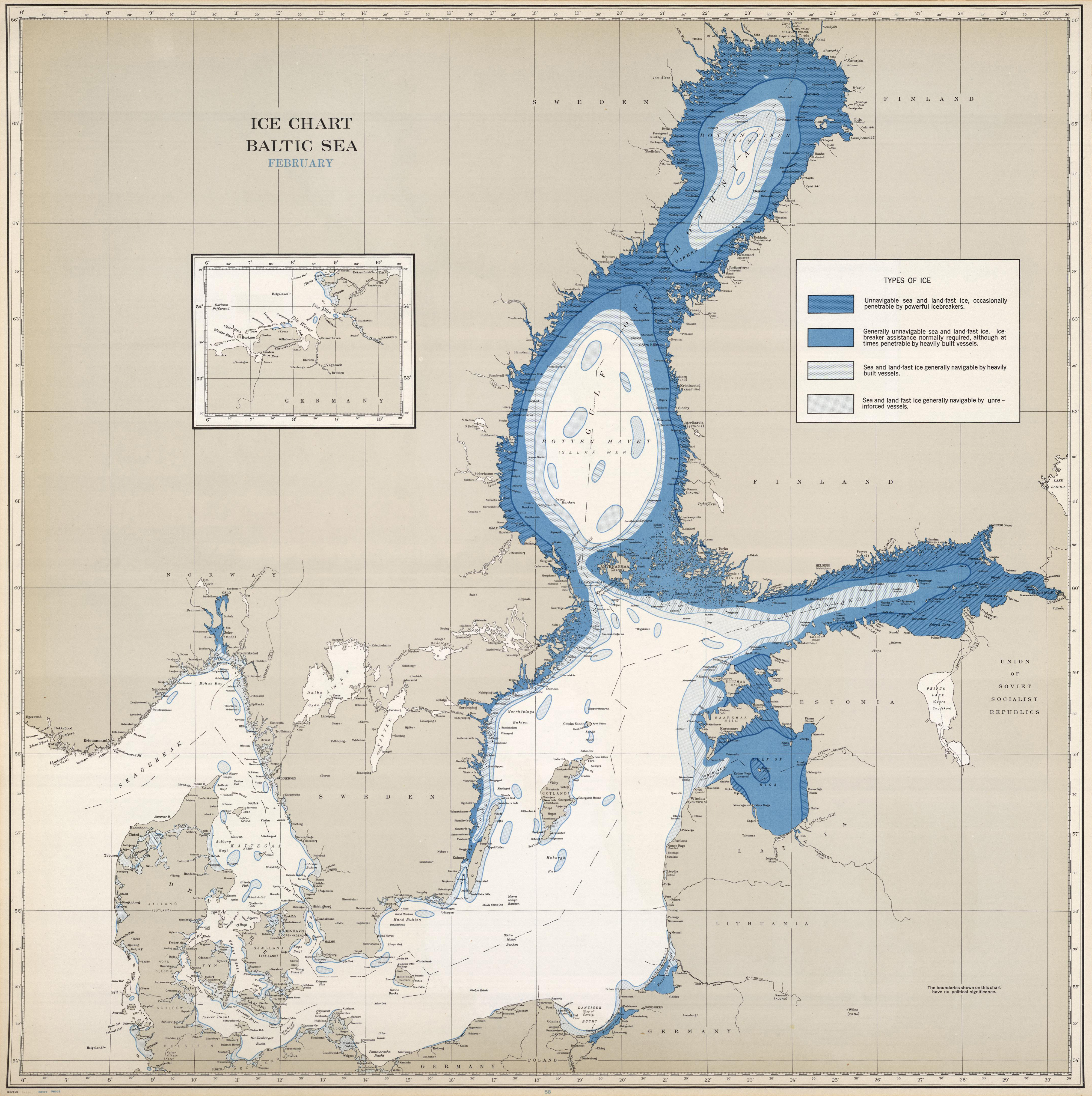
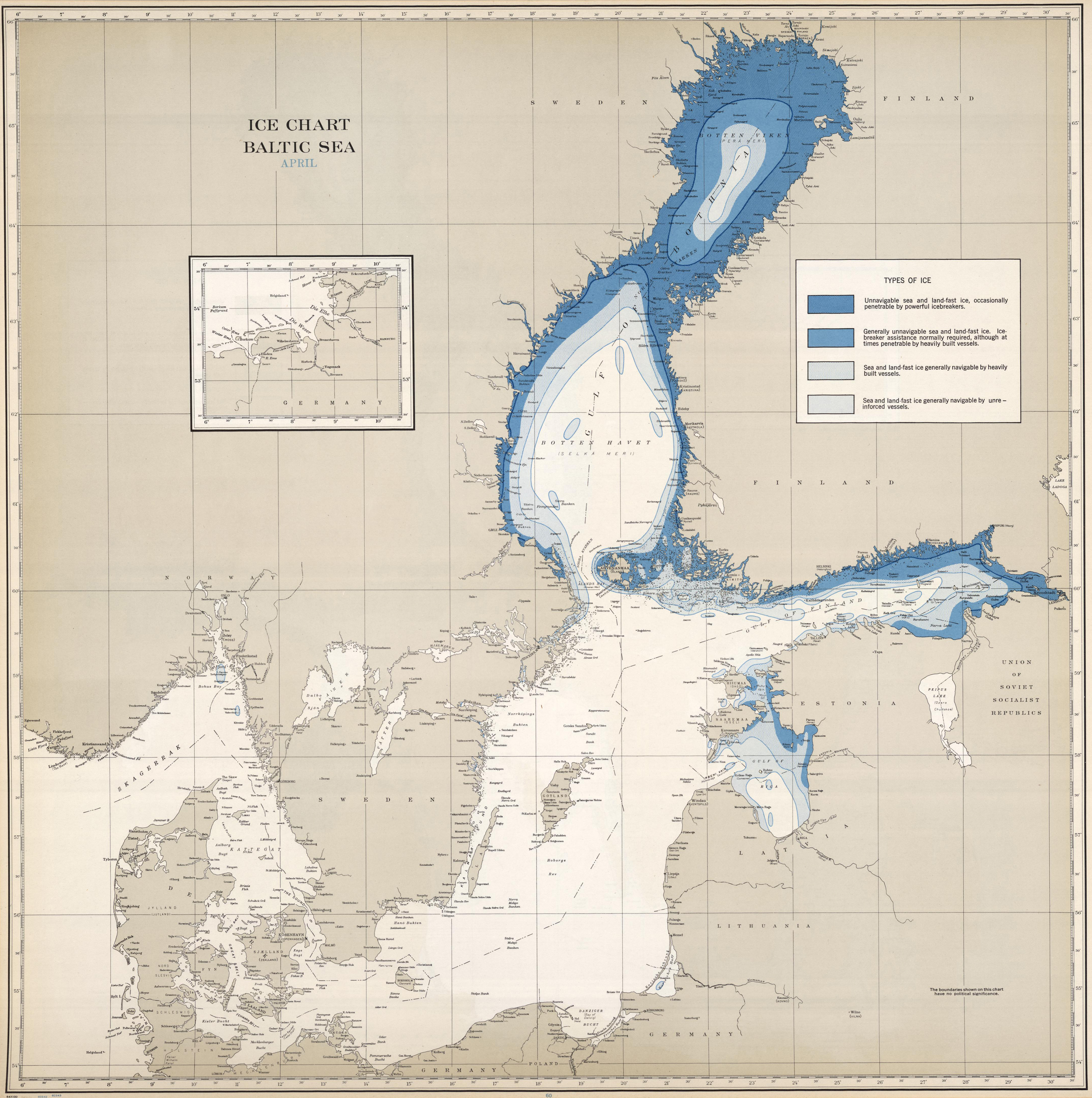
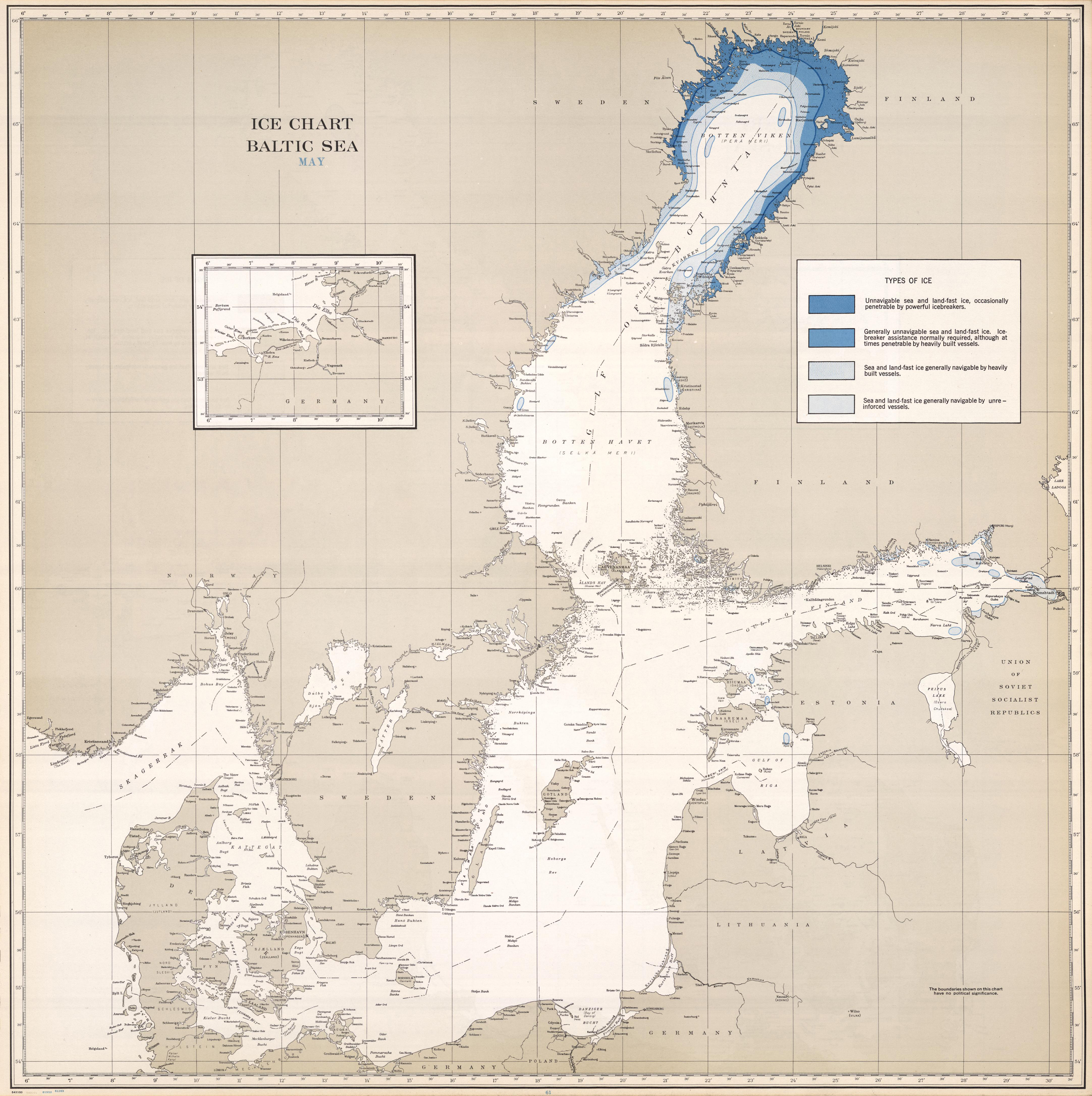
Atlas provides colored monthly maps detailing the extent and character of the ice for each principal region of the Northern Hemisphere known to have seasonal or permanent sea or lake ice. Also includes statistical tables.


58°00'00.0"N 20°00'00.0"E
Lieu: Baltic Sea
Publié: Février 2018
Catégorie: Cartographie
Lieu: Baltic Sea
Publisher: Hydrographic Office U.S. Navy
Collection: David Rumsey Map Collection
Publié: Février 2018
Catégorie: Cartographie