Aaron Arrowsmith
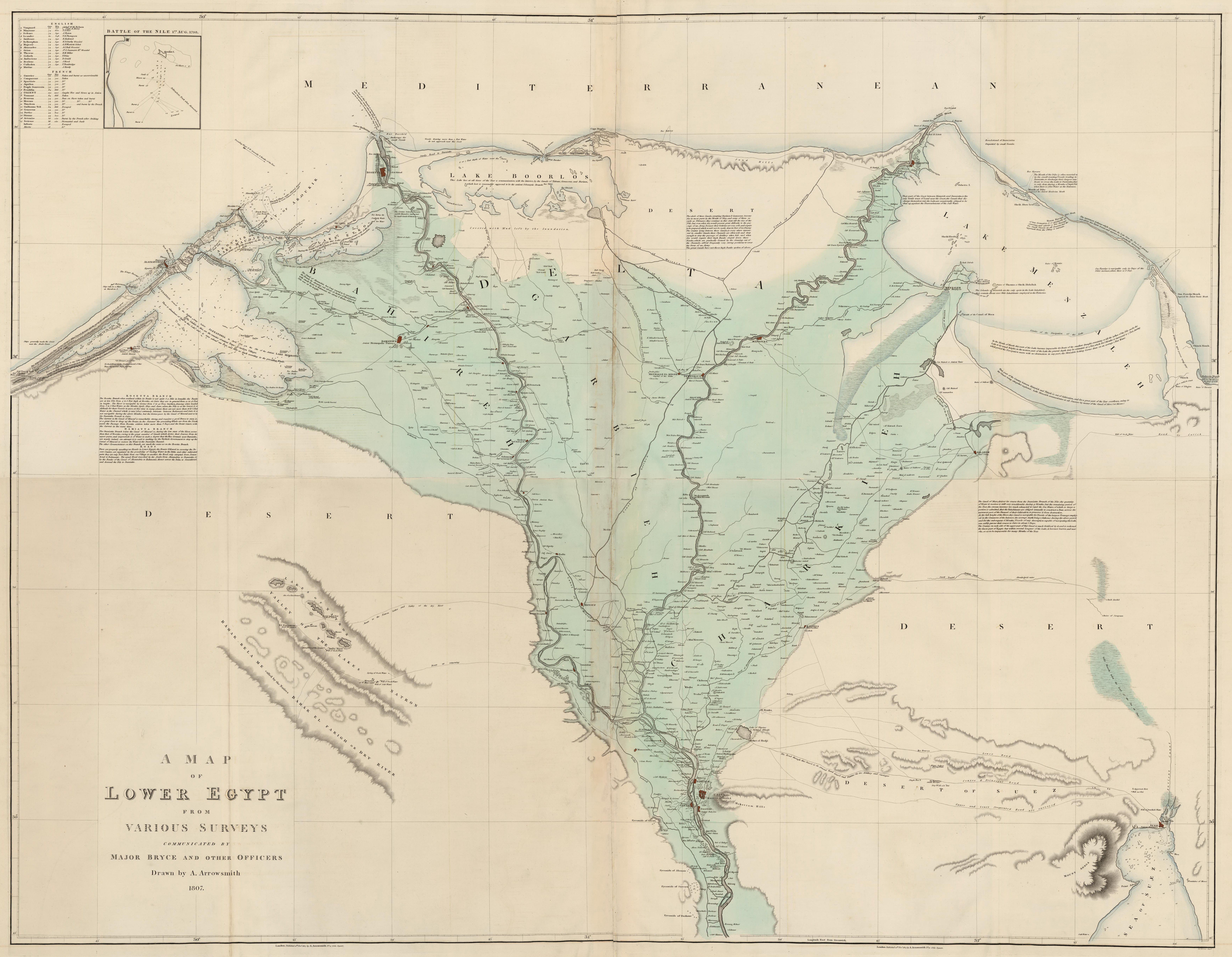
Map of Upper & Lower Egypt
1807
Large and detailed maps of Egypt published just after the failed Alexandrian Expedition, a major operation during the Anglo-Turkish War of 1807-1809. By 1806, Britain had become increasingly fearful of France’s growing influence in Constantinople. After the failure of the Dardanelles Operation in September of that year, the British sent a naval force, under the command of Alexander Mackenzie-Fraser, to secure Alexandria as a base from which to conduct their operations against the Ottomans and French.
Although initially met with little resistance, the British were hampered by supply issues and, later on, by stiff Egyptian counteraction. By the end of September they were forced to leave Alexandria having failed in their mission. A great deal of the geographical information for the map of Lower Egypt came from Sir Alexander Bryce of the Royal Engineers (d.1832), who had served under Sir Ralph Abercromby at the Battle of Alexandria of 1801. Bryce would (together with Captain W. Mudge of Ordnance Survey renown) help in carrying out General Roy’s system of triangulation for connecting the meridians of Greenwich and Paris, and in the measurement of a “base of verification” in Romney Marsh.

Lieu: Egypt
Scales: 1:186’440 - 1:701’015
Collection: David Rumsey Map Collection
Publié: Mai 2018
Catégorie: Cartographie