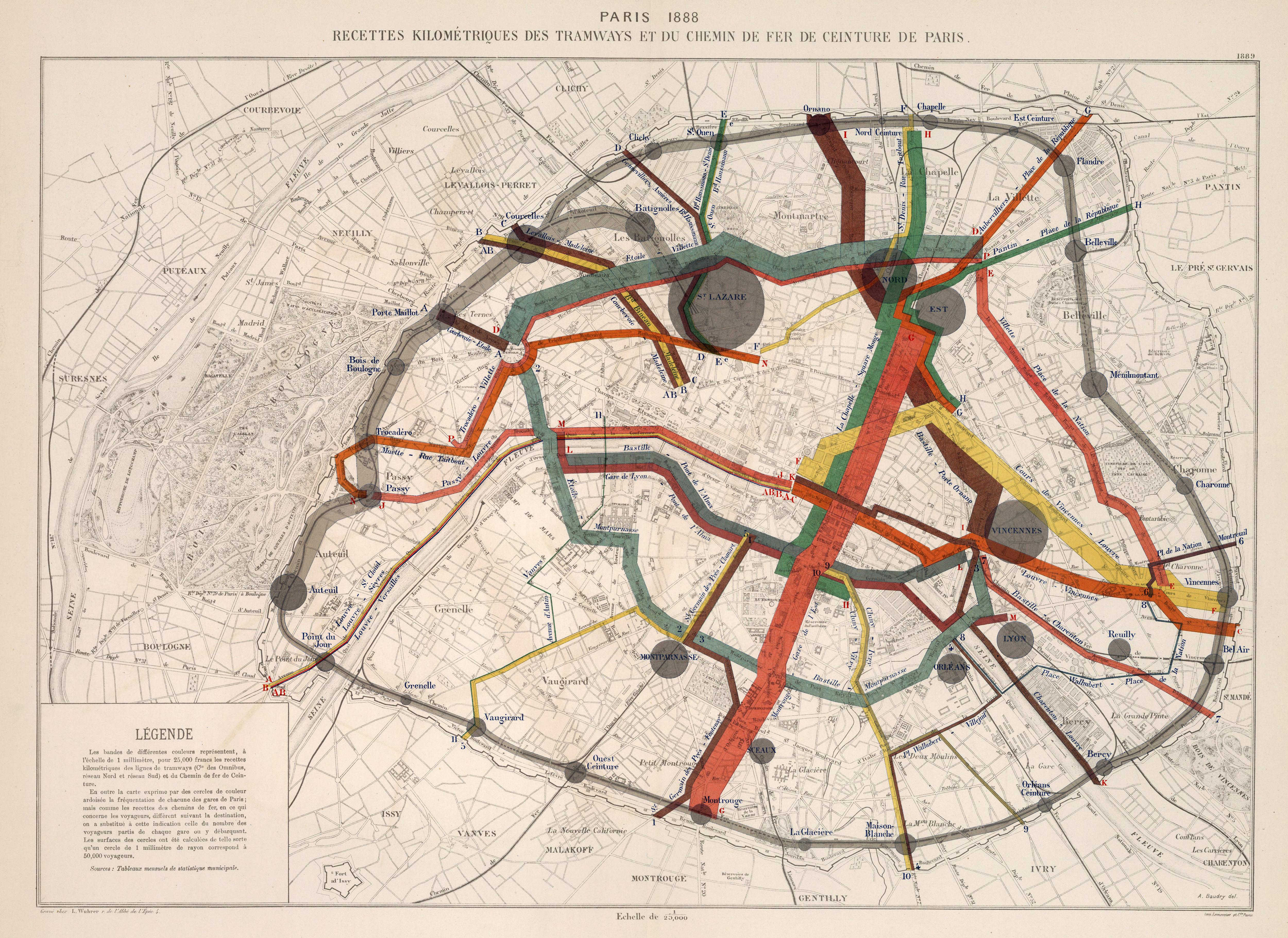
Jacques Bertillon
Paris 1888, recette kilométriques
1888–1889
48°51'24.1"N 2°21'02.9"E
Lieu: Paris, France
Publié: Novembre 2018
Catégorie: Cartographie
Lieu: Paris, France
Office: Service de la statistique municipale
Publisher: George Masson
Scale: 1:25’000
Engraver: Louis Wuhrer
Printer: A. Baudry
Collection: David Rumsey Map Collection
Publié: Novembre 2018
Catégorie: Cartographie