Alexander Thomas Emeric Vidal
Tenerife
1864
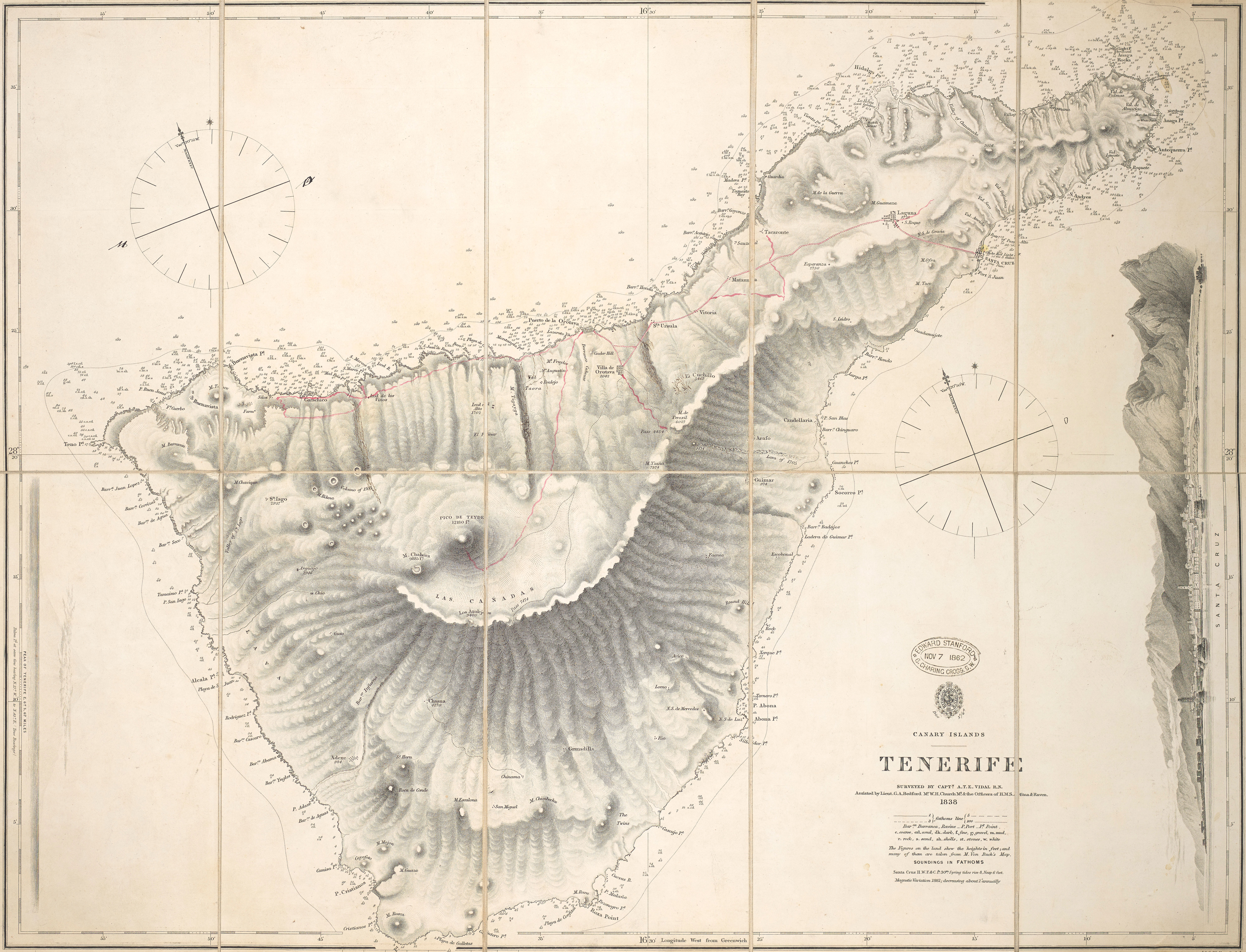
Nautical chart of Tenerife in the Canary Islands. Surveyed by Capt. A.T.E. Vidal assisted by Lieut. G.A. Bedford, Mr W.H. Church Mt., & the officers of H.M.S. Aetna & Raven (1838).
28°16'07.0"N 16°36'20.0"W
Lieu: Tenerife, Spain
Publié: Janvier 2021
Catégorie: Cartographie
Lieu: Tenerife, Spain
Collection: Leibniz-Institut für Länderkunde, Leipzig, Germany - National Maritime Museum, Greenwich, London
Text: Wikipedia
Publié: Janvier 2021
Catégorie: Cartographie