CIA
Terrain Board Collection
1958
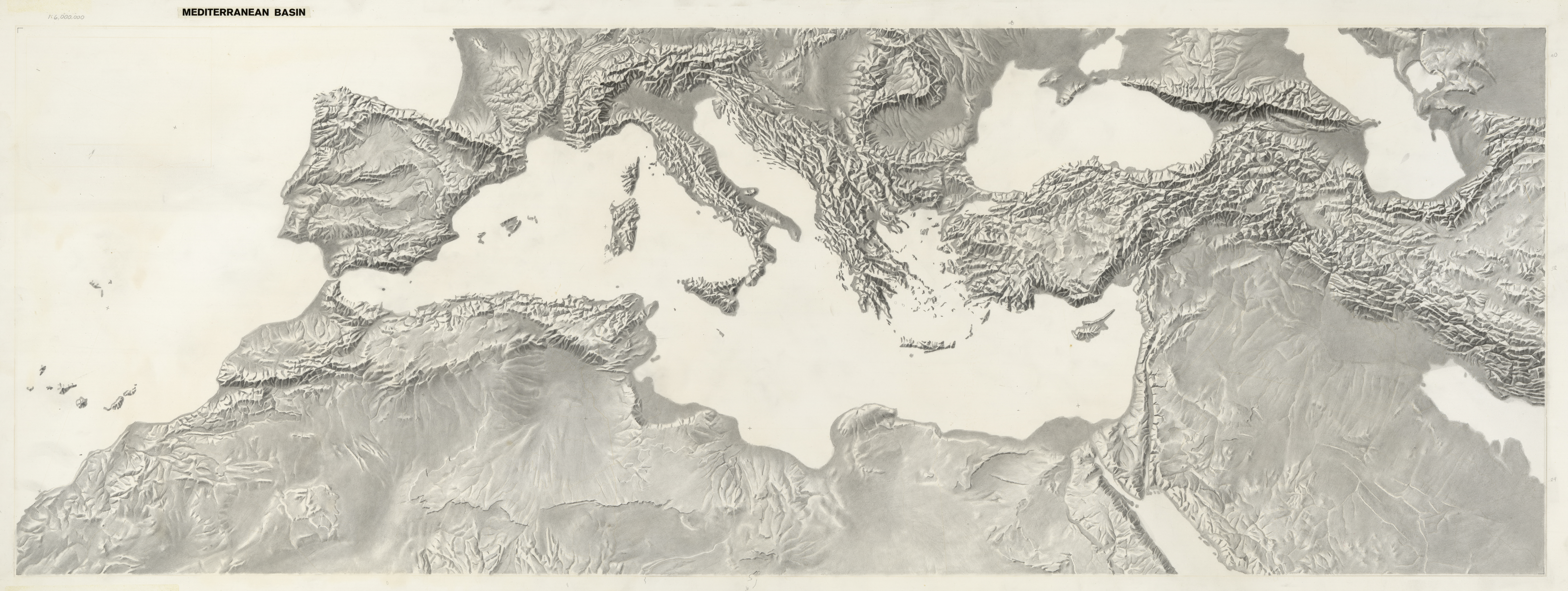
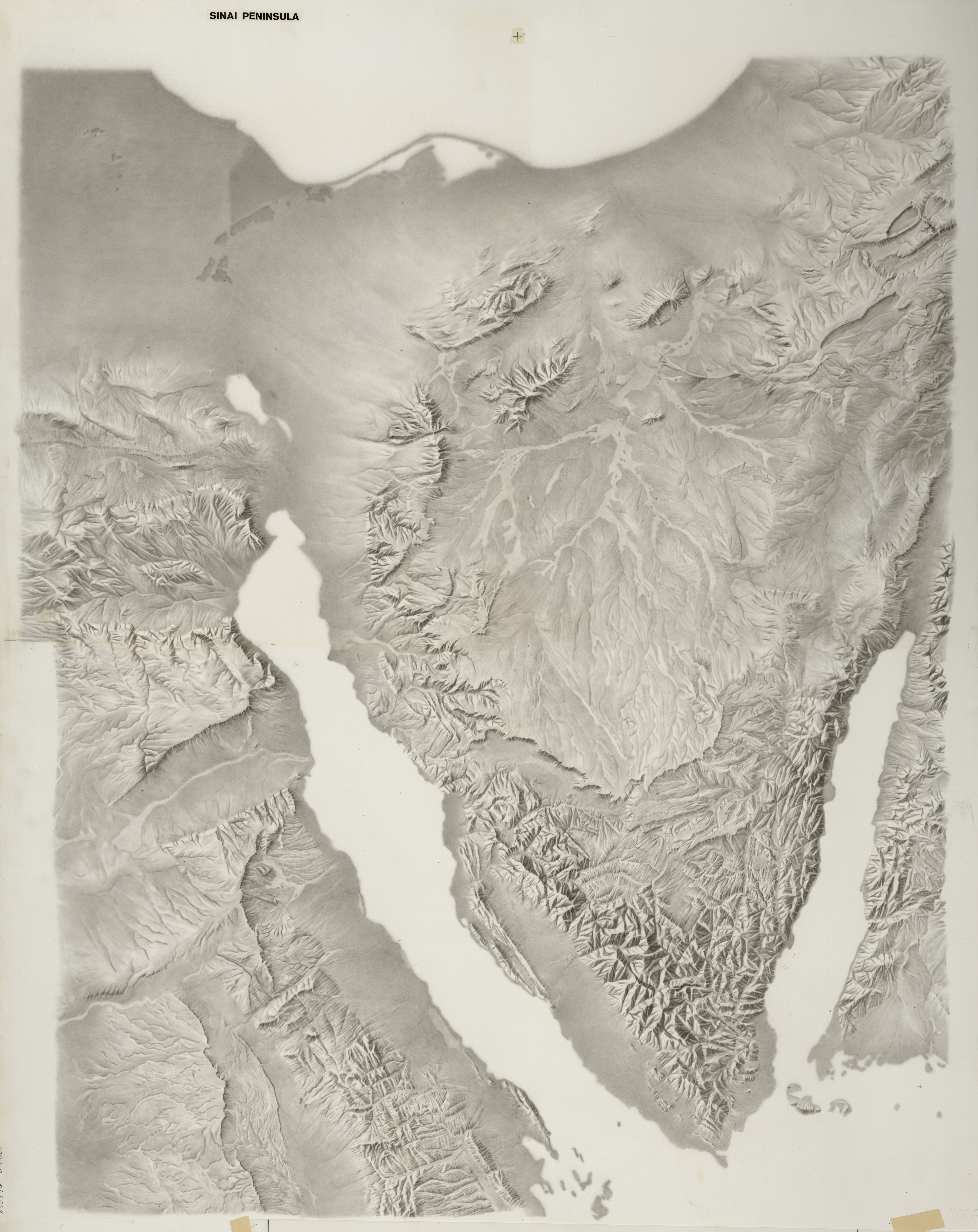
The collection consists of 34 groups of manuscript terrain maps of various regions of the world, prepared using Swiss “ridge and valley” techniques by the Central Intelligence Agency’s terrain specialists. The base terrain maps (shaded relief and lowland tints) were drawn on boards created from two sheets of paper fused to an aluminum core. The boards are accompanied by 1 to 4 manuscript overlays showing reference line work, etc. The collection documents sophisticated manual terrain mapping techniques now generally replaced by computer generated terrain renderings using digital data. The majority of the maps were prepared using Lambert’s conformal conic projection, while the remainder use the universal transverse Mercator projection.