Christoffer Rudquist
Tokyo Flooding
2017
Surprisingly – for an area built on a flood plain and an active volcanic belt, and beset by frequent typhoons – the small fishing village of Edo would, by the 18th century, become the de facto capital of Japan. Yet Tokyo, as it became known in 1868, is now the largest megacity on the planet, swelling over some 13,500 square kilometres to house more than 50 million people, despite the myriad of geological challenges it faces.
Flooding is nothing new to Tokyo and its surrounding area, but with the region’s rapid urbanisation since the middle of the 20th century, the threat of catastrophic flooding has grown ever more severe; a typhoon in 1991, for example, flooded 100 square kilometres, over 30,000 homes and caused the deaths of 52 people. With existing defences struggling and urban space at a premium, the government’s engineers looked underground.
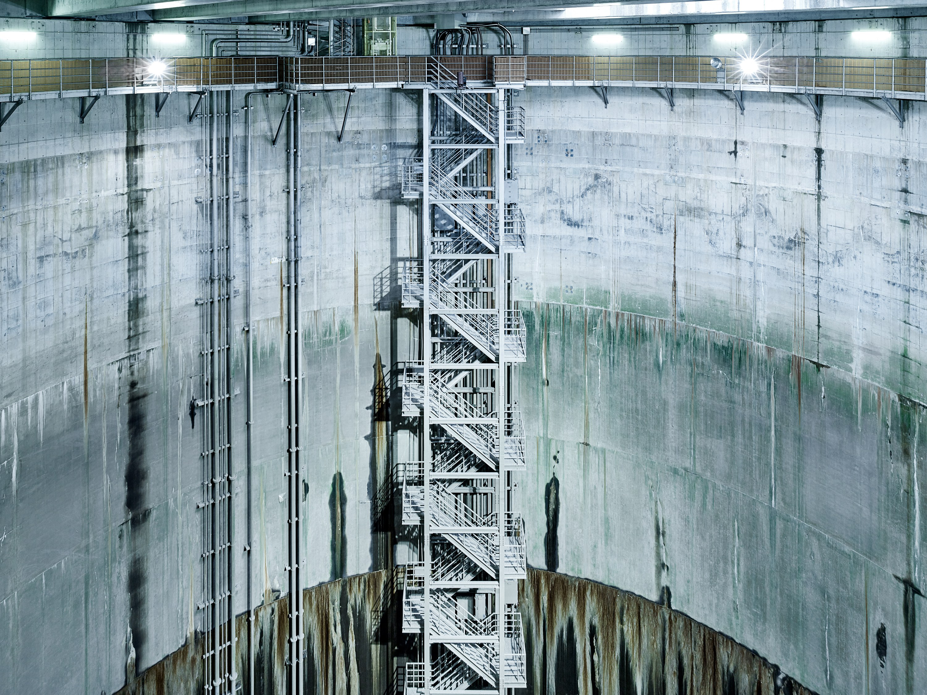
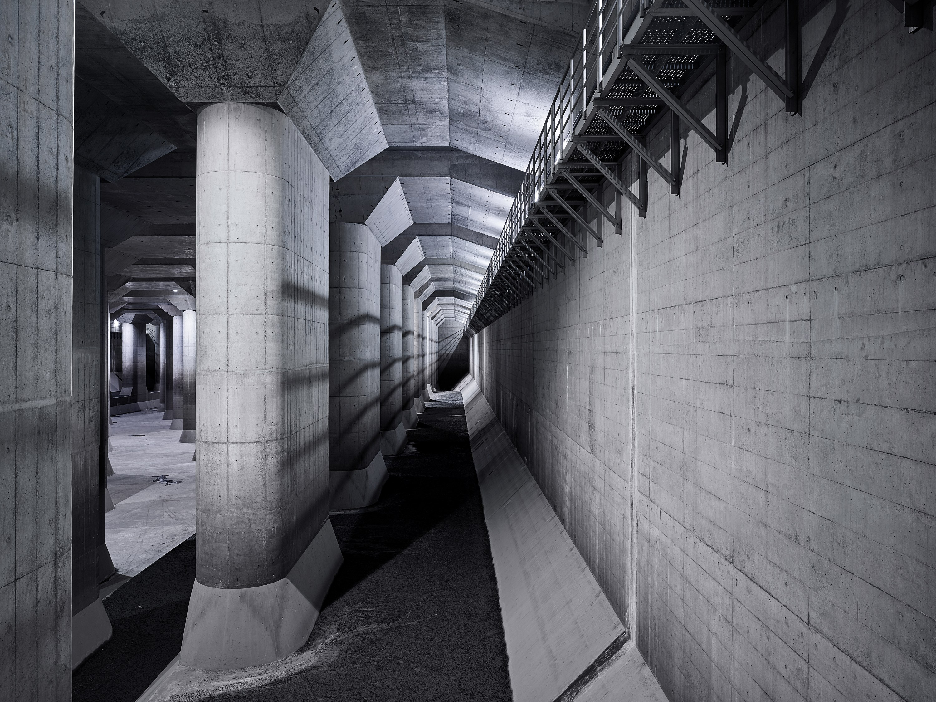
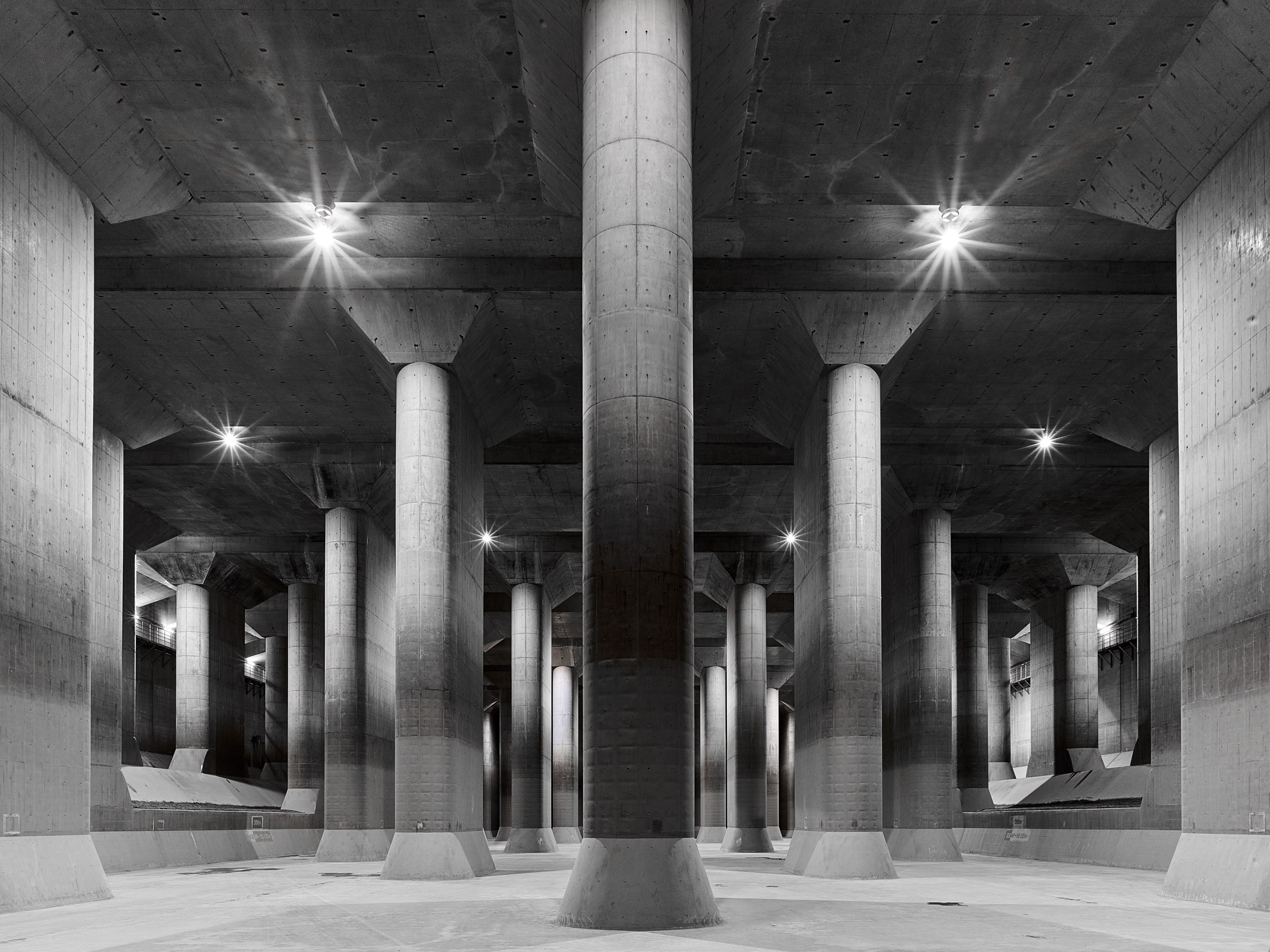
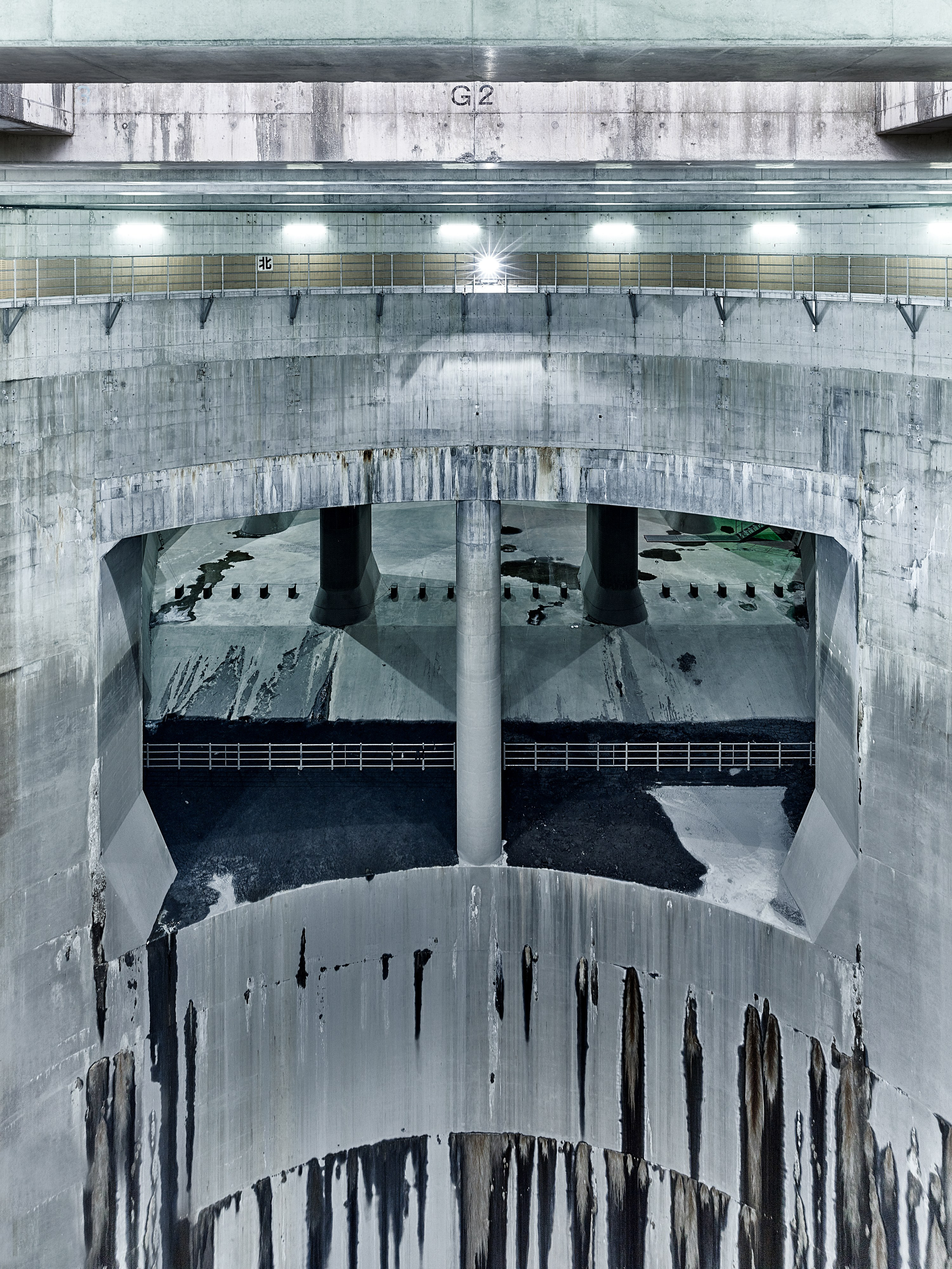
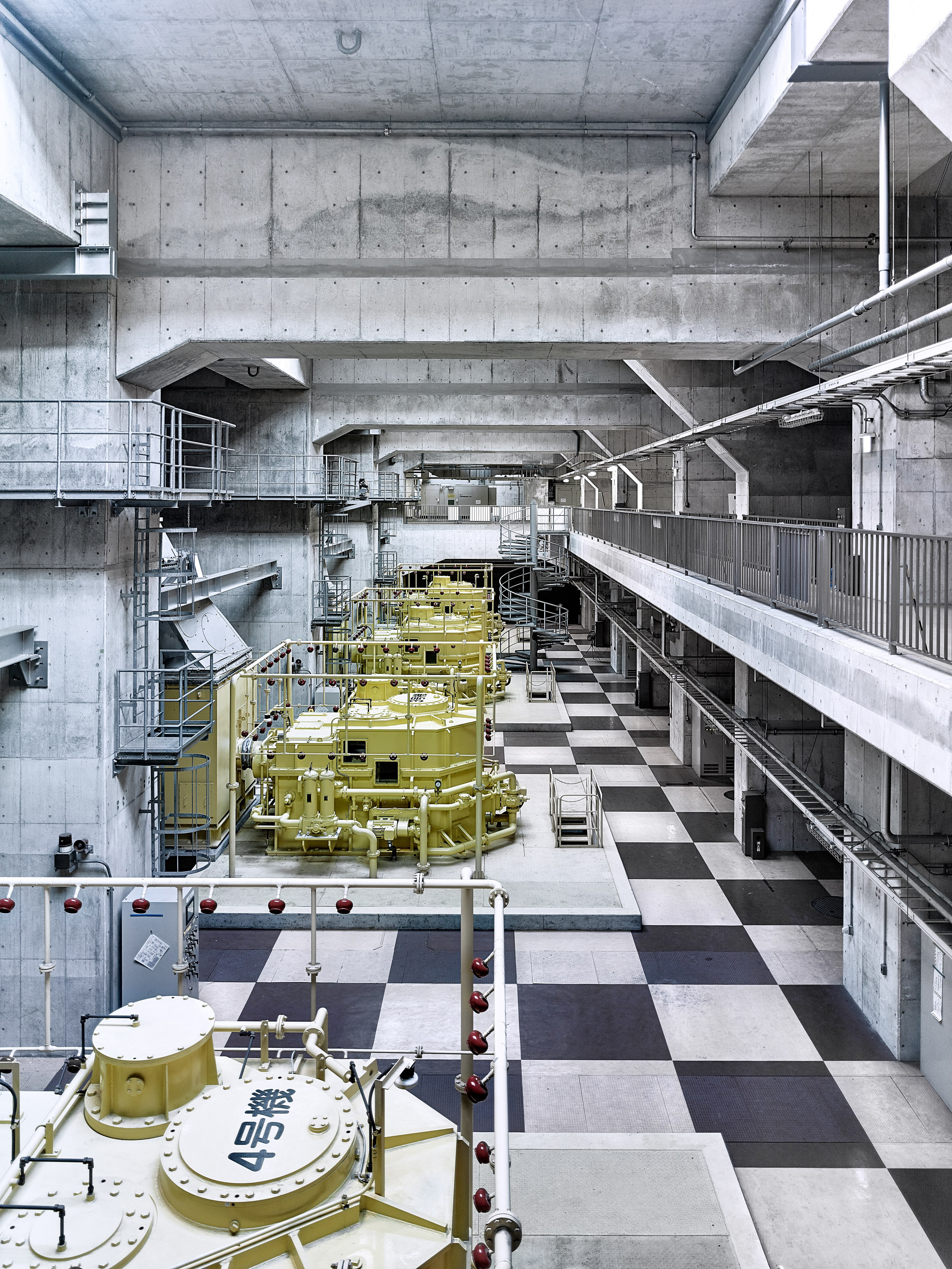
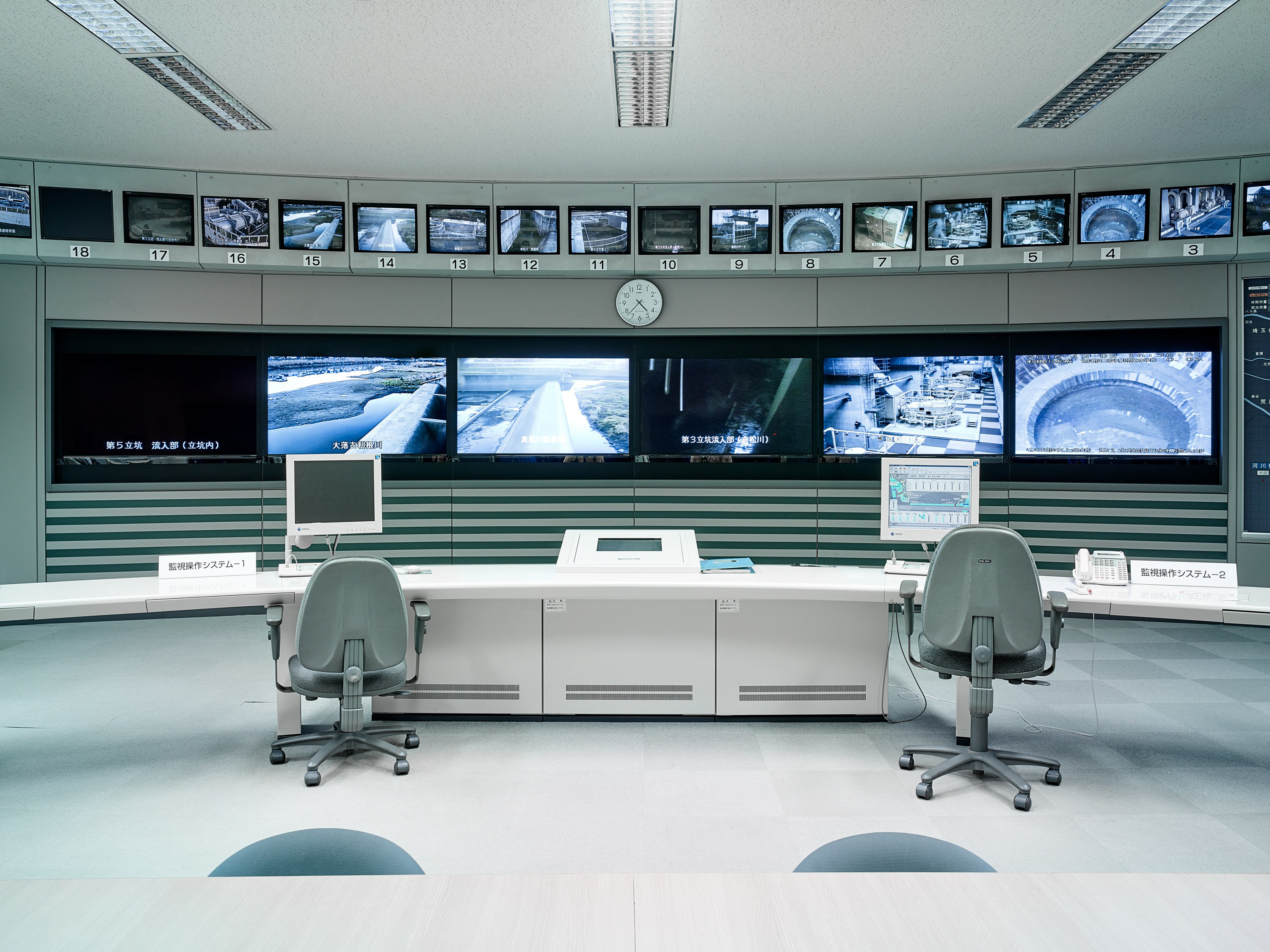
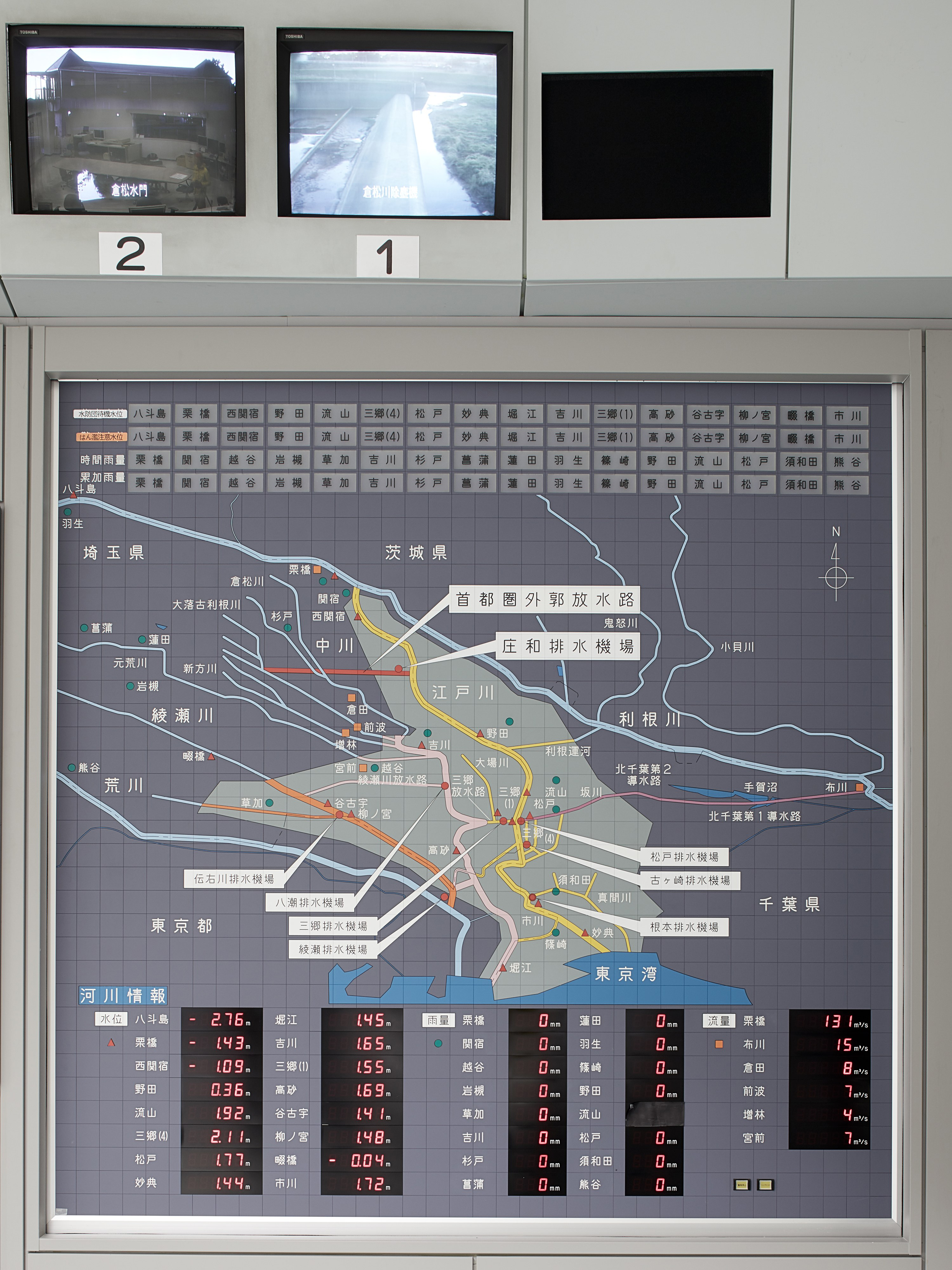
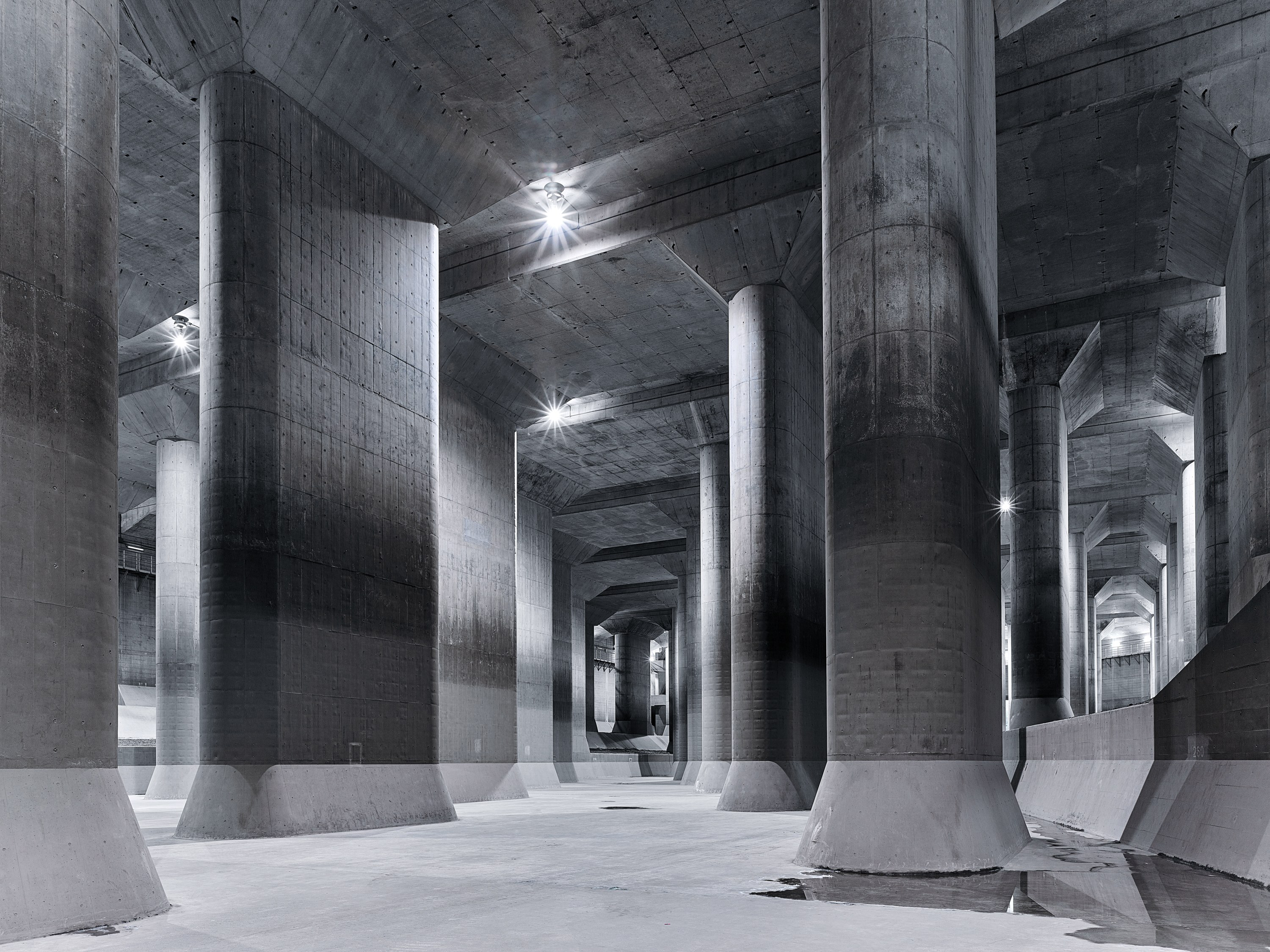
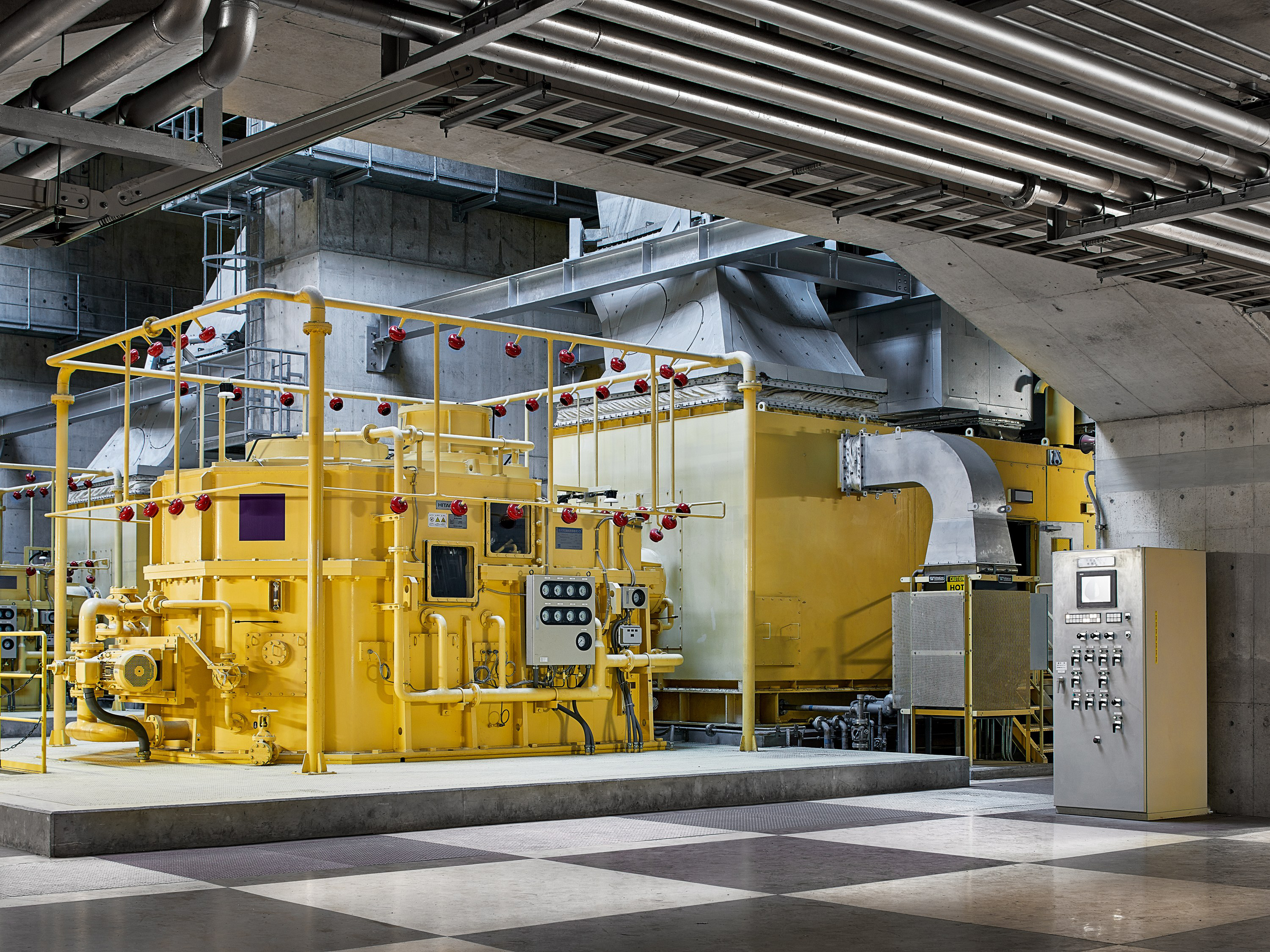
The result was the Metropolitan Area Outer Underground Discharge Channel, a series of vast concrete silos built between 1993 and 2006 that each drain five rivers – stretching from the Oootoshifurutone in Saitama prefecture, north of Tokyo, to the drainage pump station at the Edo River in the city itself – connected by a 6.3km-long channel.
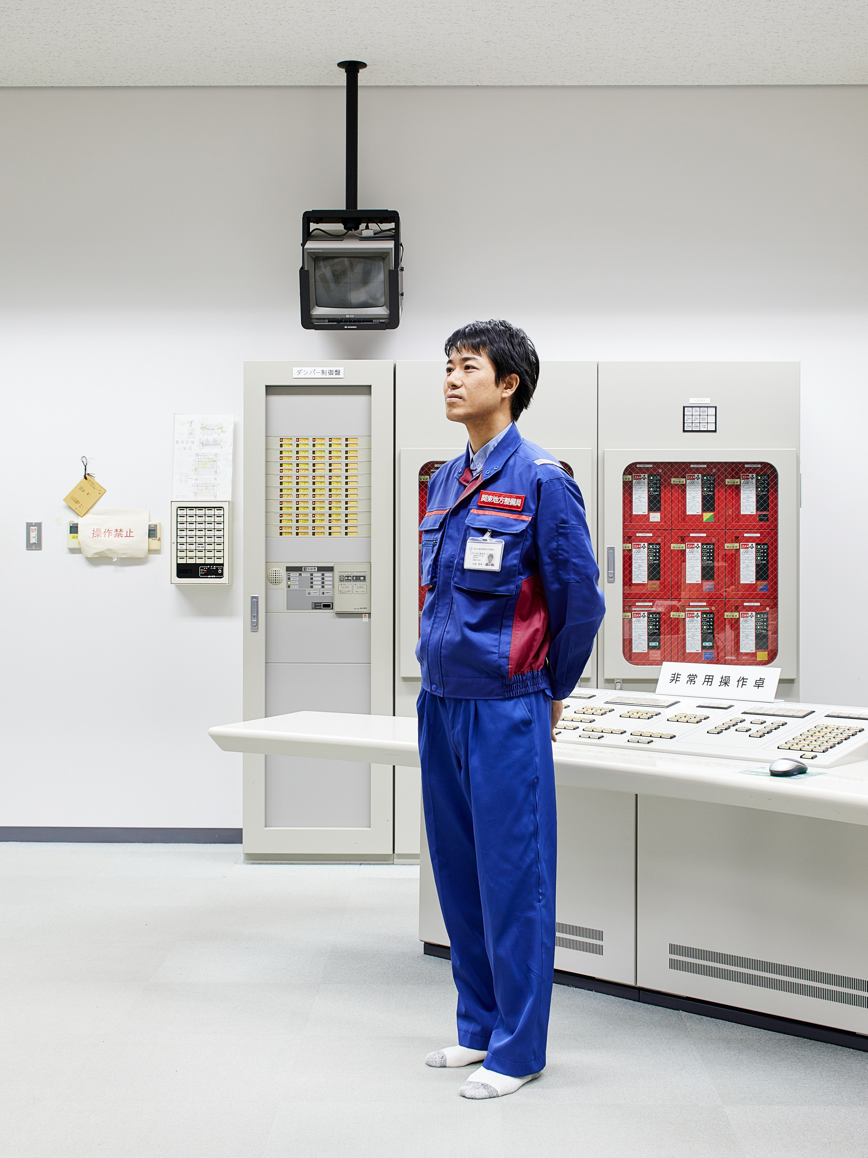
With each silo around 70 metres tall and 30 metres wide – large enough to fit the Statue of Liberty or a space shuttle inside – it is the biggest storm drain in the world. Though the cost of the project – $3 billion – was remarkable, the consequences of not undertaking the project would have been greater. As Takayuki Yabe, the system’s subsection chief, explains, “If it was not built, there would have already been cases in which flooding damage was enormous.”
Lieu: Tokyo, Japan
Editor: Avaunt Magazine
Publié: Mai 2017
Catégorie: Photographie
Source