Observation

orthos logos

Atlas of Infrastructure II

2016

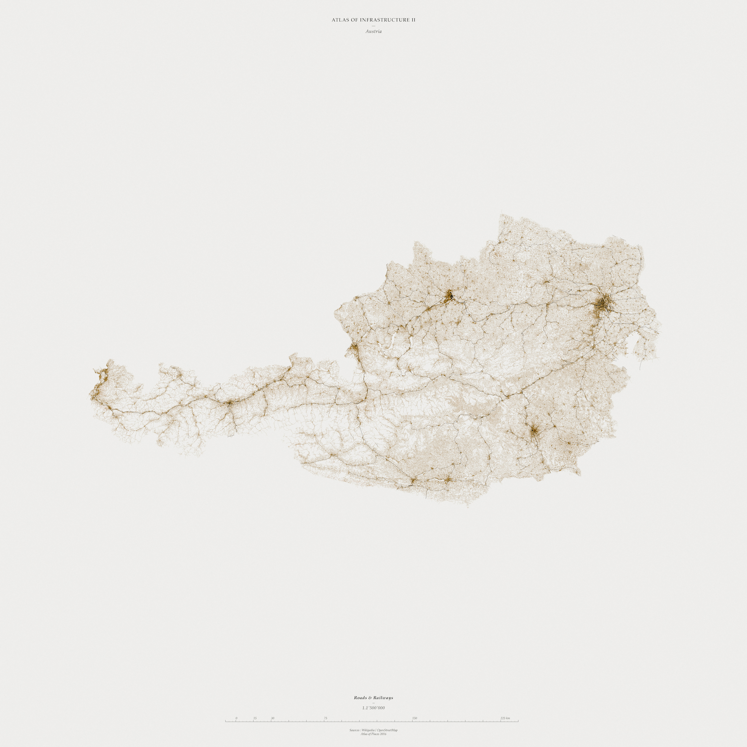
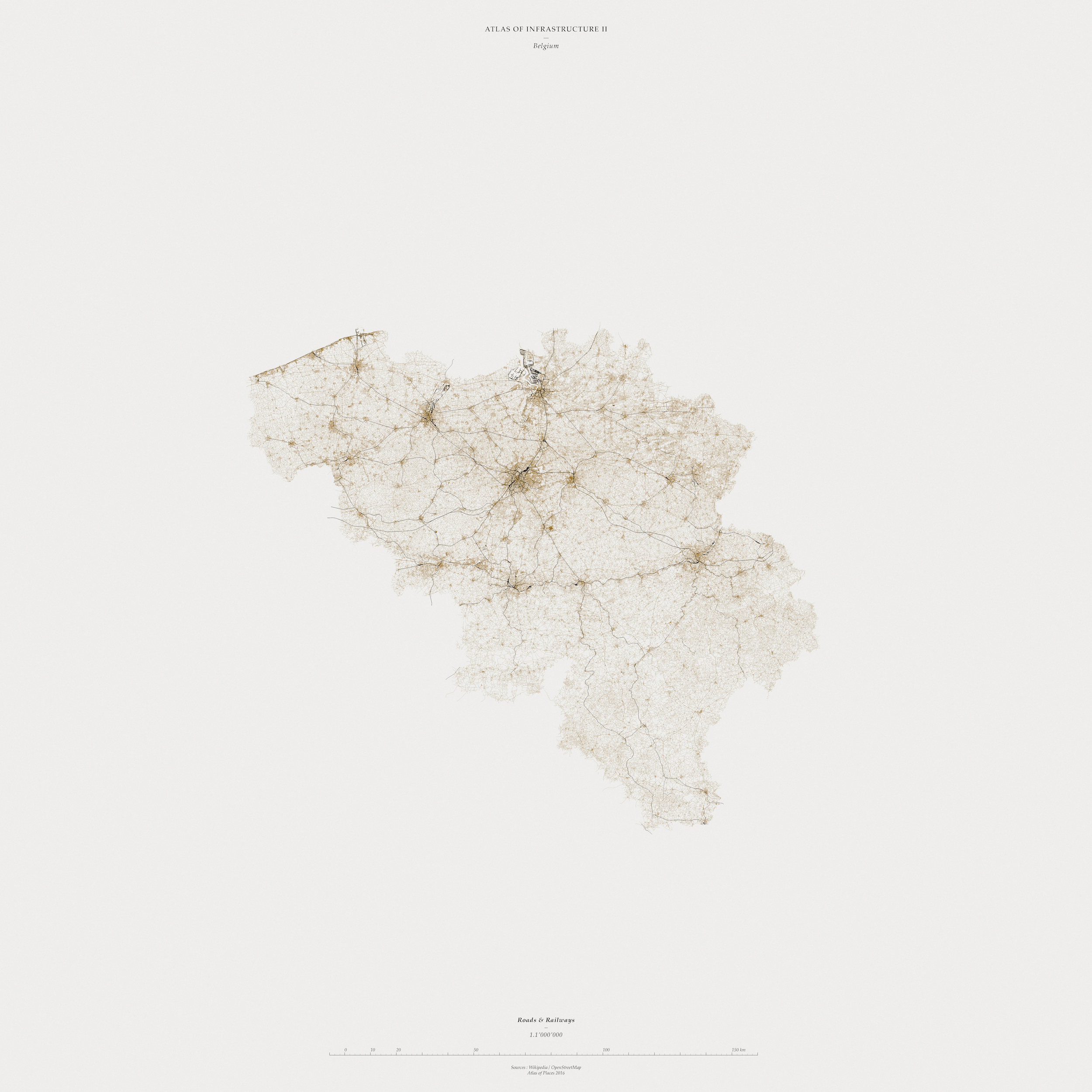
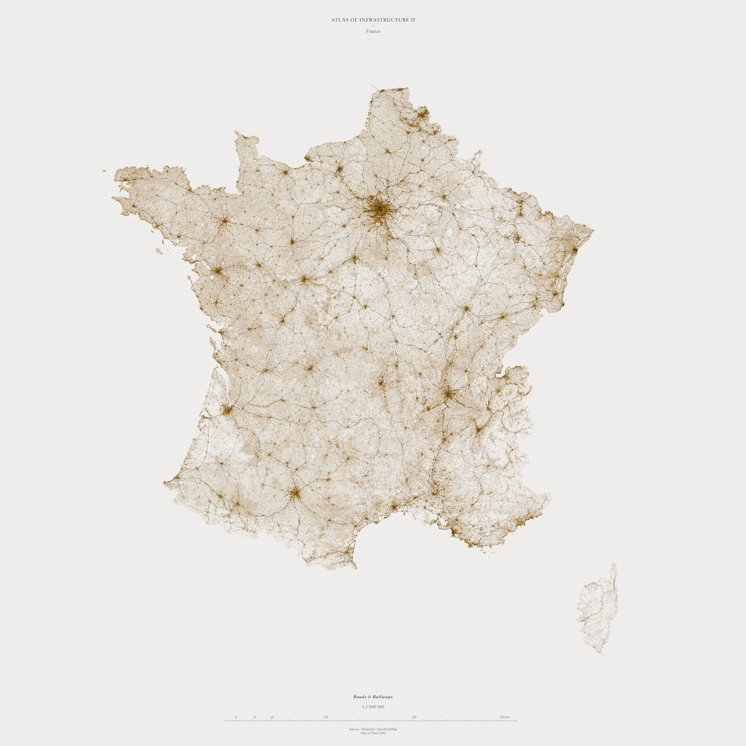
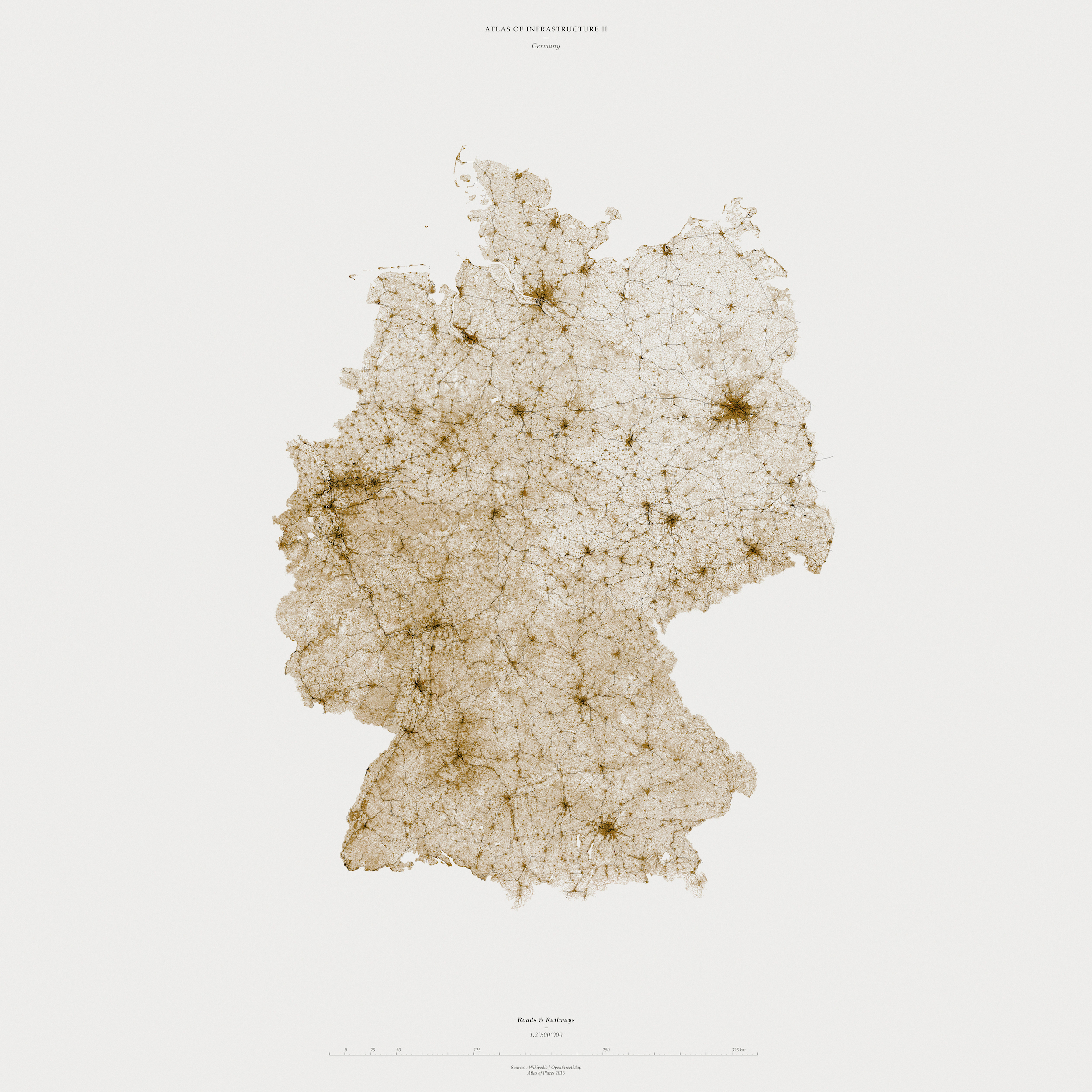
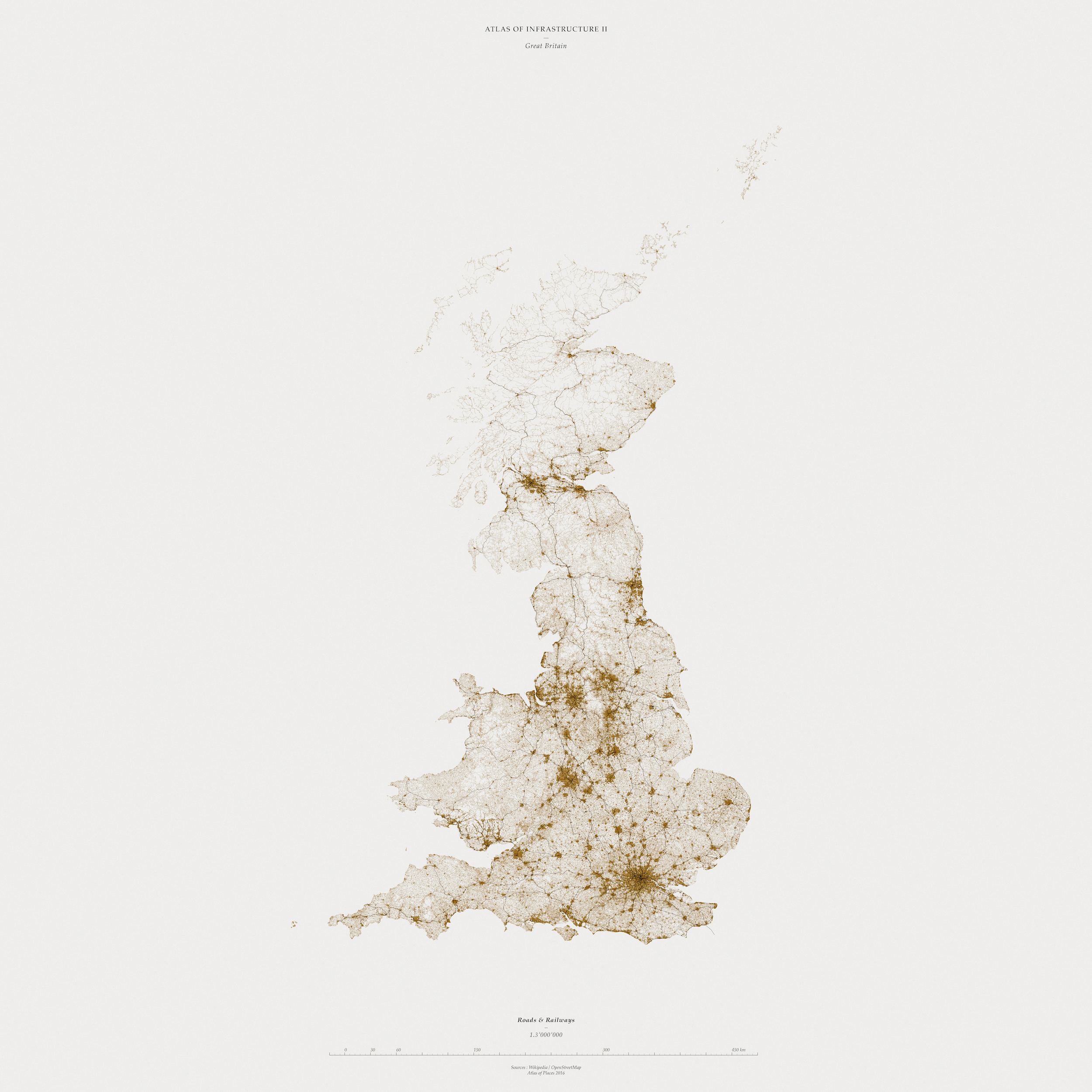
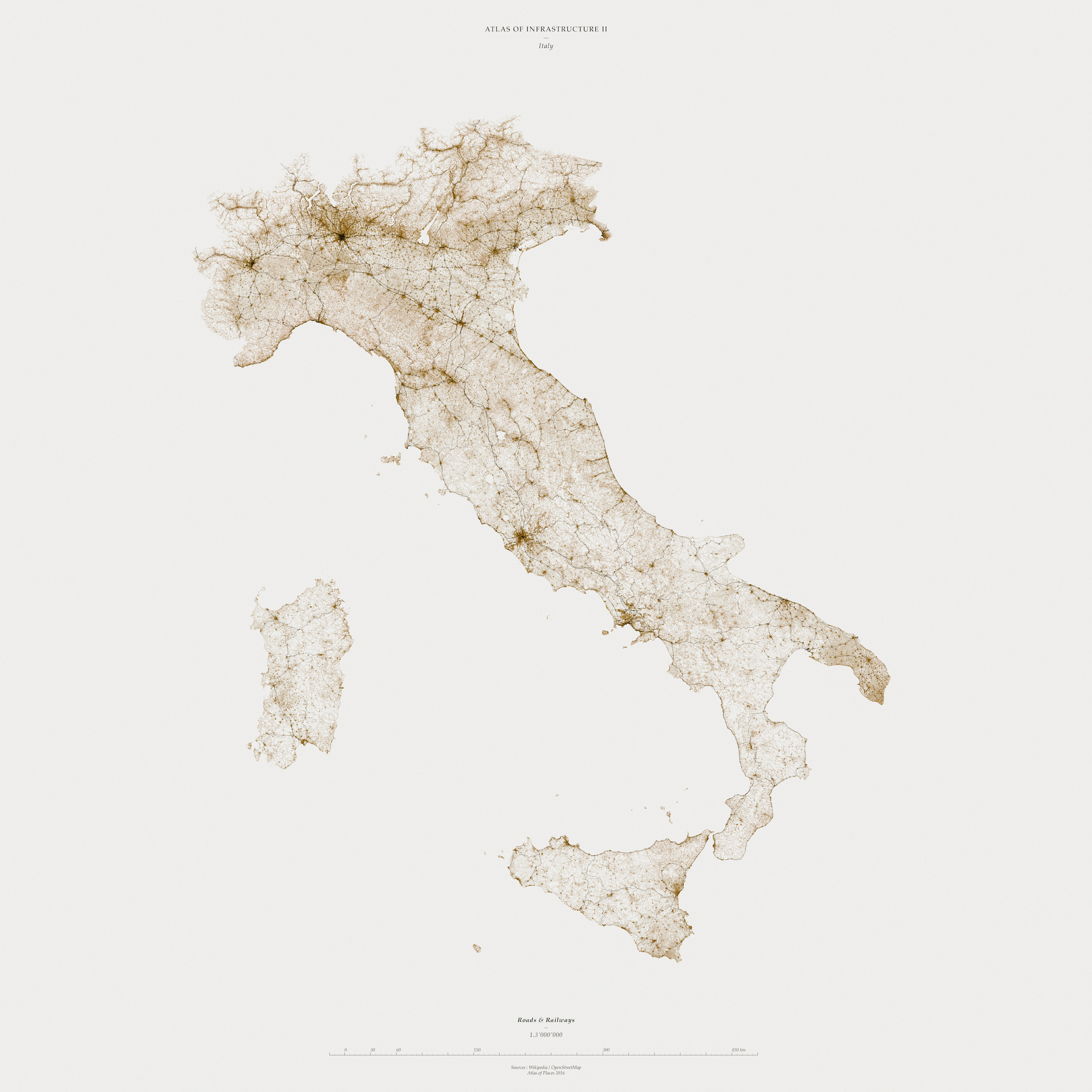
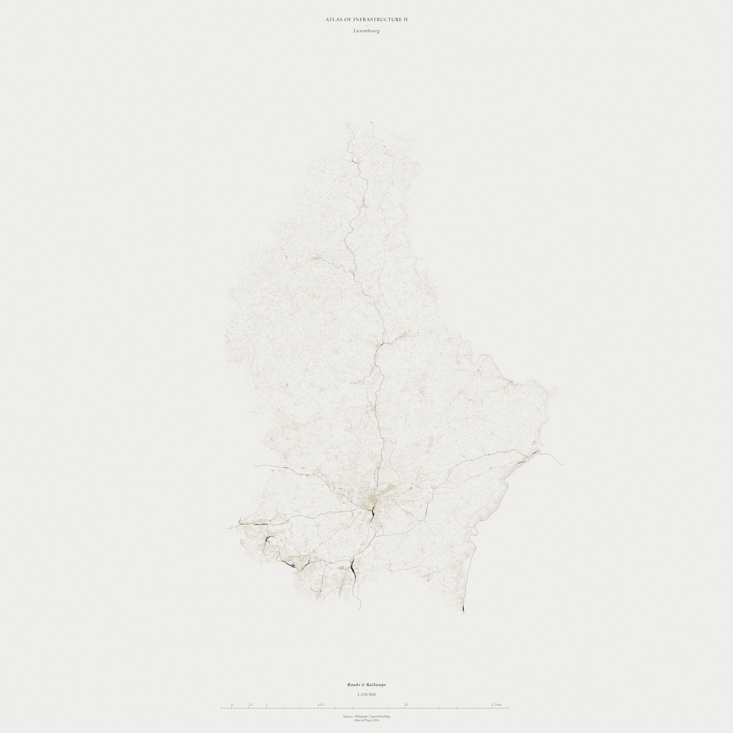
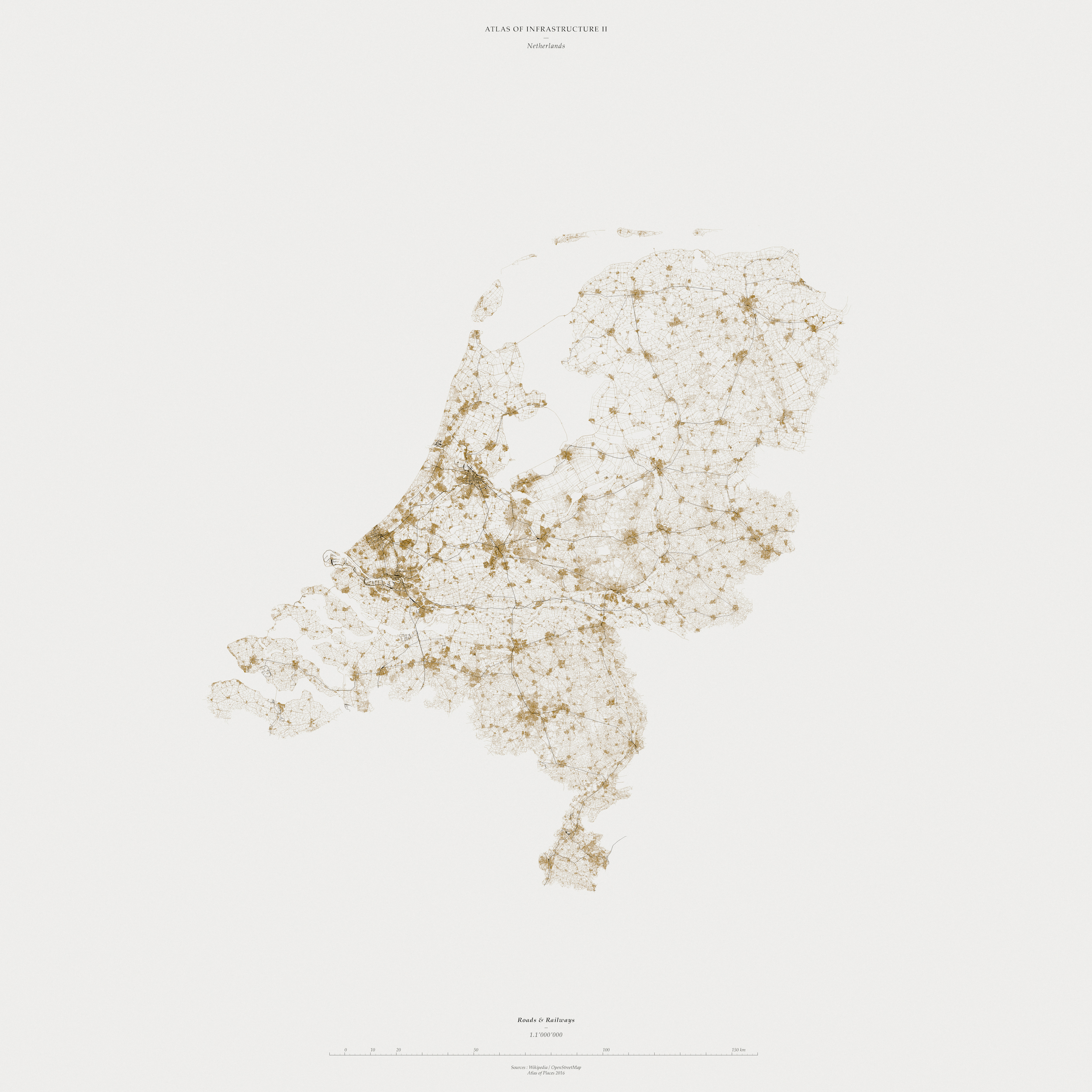
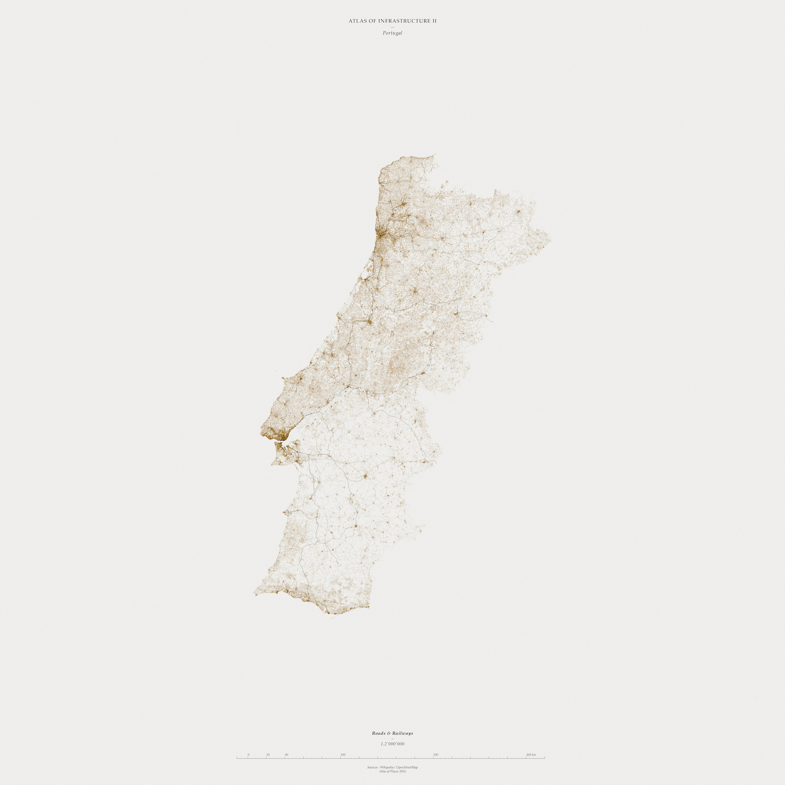
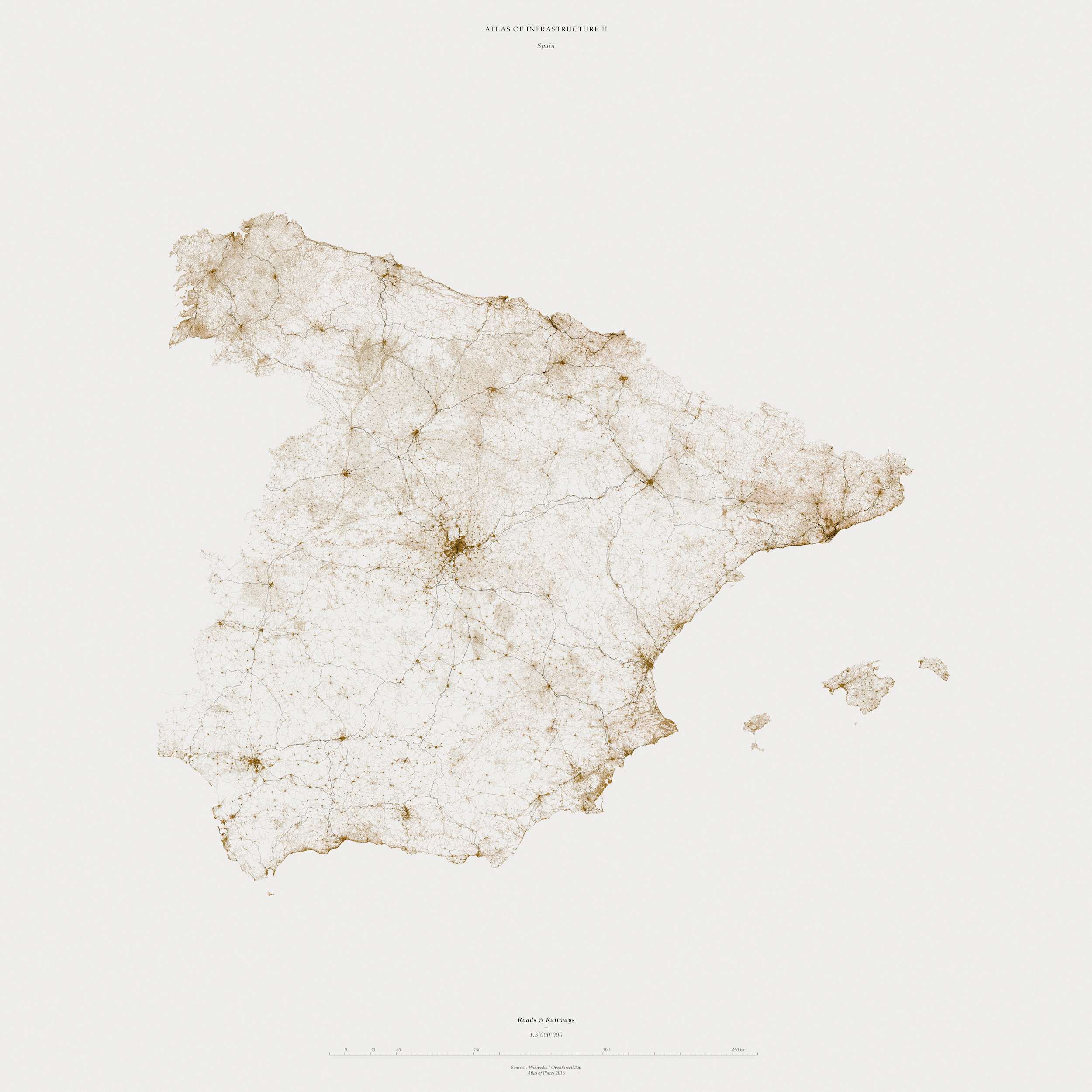
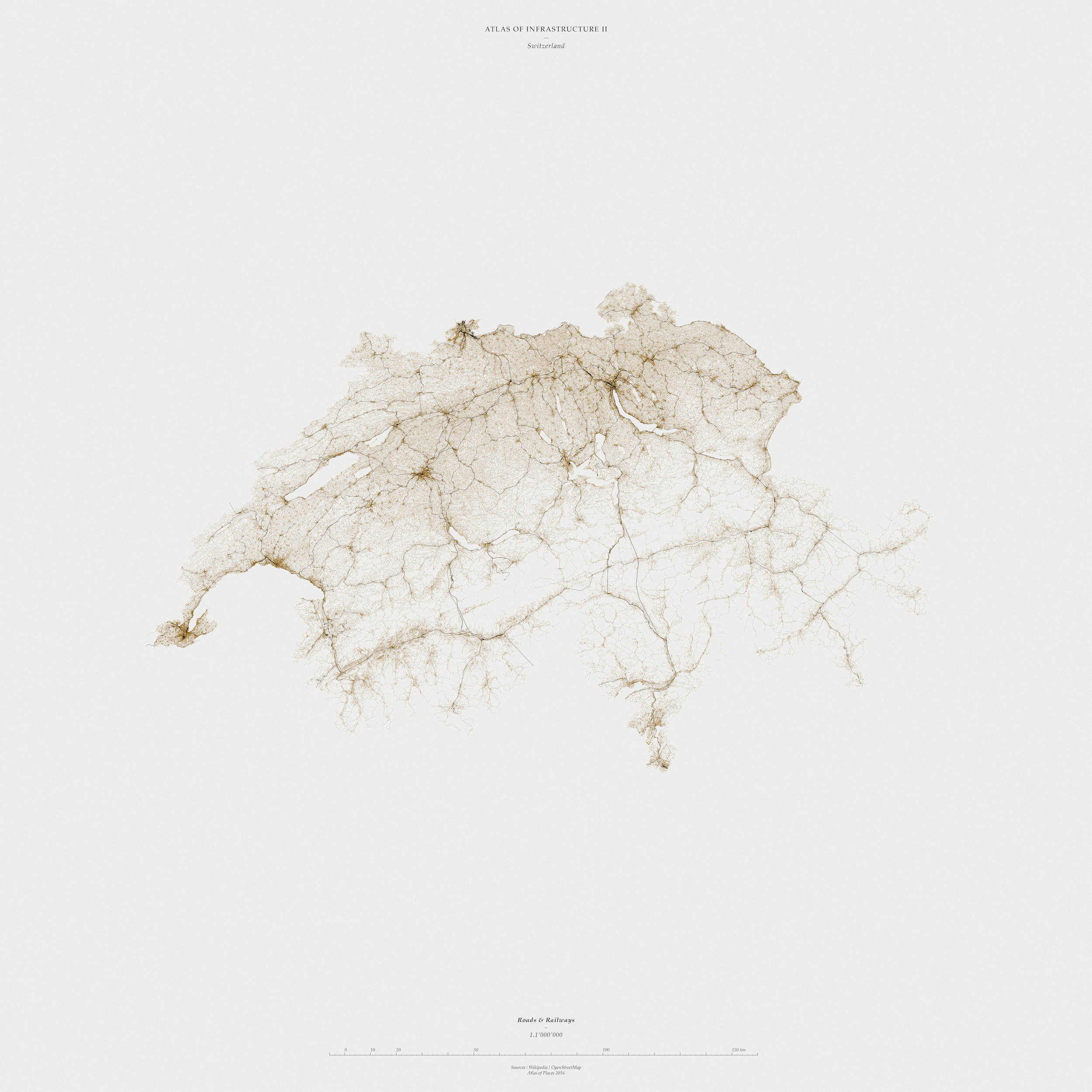
Cars, roads, municipal water supplies, sewers, telephones, railroads, weather forecasting, building, even computers in the majority of their uses – reside in a naturalised background, as ordinary and unremarkable to us as trees, daylight and dirt. Our civilisations fundamentally depend on them, yet we notice them mainly when they fail, which luckily for us they rarely do. They are the connective tissues and the circulatory systems of modernity. A well functioning infrastructure is by definition invisible, because its very purpose is to provide a basis for other activities - to accommodate different actors, their shifting goals, and modes of engagement. Only when it breaks down does infrastructure come to the fore.

Atlas of Infrastructure II
Austria - 1:1'500'000 - 100x100 cm
Atlas of Infrastructure II
Belgium - 1:1'000'000 - 100x100 cm
Atlas of Infrastructure II
France - 1:3'000'000 - 100x100 cm
Atlas of Infrastructure II
Germany - 1:2'500'000 - 100x100 cm
Atlas of Infrastructure II
Great Britain - 1:3'000'000 - 100x100 cm
Atlas of Infrastructure II
Ireland - 1:1'500'000 - 100x100 cm
Atlas of Infrastructure II
Italy - 1:3'000'000 - 100x100 cm
Atlas of Infrastructure II
Luxembourg - 1:250'000 - 100x100 cm
Atlas of Infrastructure II
Netherlands - 1:1'000'000 - 100x100 cm
Atlas of Infrastructure II
Portugal - 1:2'000'000 - 100x100 cm
Atlas of Infrastructure II
Spain - 1:3'000'000 - 100x100 cm
Atlas of Infrastructure II
Switzerland - 1:1'000'000 - 100x100 cm
Atlas of Infrastructure II
Western Europe - 1:3'500'000 - 200x200 cm
Atlas of Infrastructure II
Lieu: Western Europe

Projection: WGS84
Text: Paul N. Edwards


Publié: Décembre 2016
Catégorie: Observation